

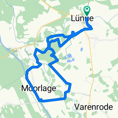
Aatal und Moor -Route
A cycling route starting in Lünne, Lower Saxony, Germany.
Overview
About this route
Route over Spelle, Schleise Venhaus, Lünne, Beesten en Schapen
- -:--
- Duration
- 47.3 km
- Distance
- 35 m
- Ascent
- 38 m
- Descent
- ---
- Avg. speed
- ---
- Avg. speed
Route quality
Waytypes & surfaces along the route
Waytypes
Quiet road
25.8 km
(55 %)
Track
11.5 km
(24 %)
Surfaces
Paved
28.7 km
(61 %)
Unpaved
2.5 km
(5 %)
Paved (undefined)
22.1 km
(47 %)
Asphalt
4.3 km
(9 %)
Route highlights
Points of interest along the route
Point of interest after 20.4 km
Autmaring`sche Mühle muehle 17autmaring Neben Enking´s Mühle in Emsbüren ist die Autmaring’sche Mühle in Schapen die einzige emsländische Mühle, die aus Steinen errichtet wurde. Ihre Ursprünge gehen bis ins Jahr 1825 zurück. Bis zu Beginn der 1970er Jahre war diese steinerne Rundmühle voll funktionstüchtig.
Point of interest after 20.4 km
Töddenhaus Urschen
Point of interest after 32.3 km
Schwimmhalle Speller Welle
Continue with Bikemap
Use, edit, or download this cycling route
You would like to ride Aatal und Moor -Route or customize it for your own trip? Here is what you can do with this Bikemap route:
Free features
- Save this route as favorite or in collections
- Copy & plan your own version of this route
- Sync your route with Garmin or Wahoo
Premium features
Free trial for 3 days, or one-time payment. More about Bikemap Premium.
- Navigate this route on iOS & Android
- Export a GPX / KML file of this route
- Create your custom printout (try it for free)
- Download this route for offline navigation
Discover more Premium features.
Get Bikemap PremiumFrom our community
Other popular routes starting in Lünne
 Bramsche Rundtour Listruper Wehr
- Distance
- 20.5 km
- Ascent
- 71 m
- Descent
- 70 m
- Location
- Lünne, Lower Saxony, Germany
 Womo-Moorlage-Dortmund -Emskanal-Ems-Womo
- Distance
- 19.3 km
- Ascent
- 80 m
- Descent
- 80 m
- Location
- Lünne, Lower Saxony, Germany
 Wintermanns Tannen
- Distance
- 20 km
- Ascent
- 527 m
- Descent
- 522 m
- Location
- Lünne, Lower Saxony, Germany
 Lingen-Br.Messingen, Baccum, Mundersum
- Distance
- 24.6 km
- Ascent
- 66 m
- Descent
- 67 m
- Location
- Lünne, Lower Saxony, Germany
 Lingen-Br. Brümsel, Lünne, Hesselte
- Distance
- 26.7 km
- Ascent
- 67 m
- Descent
- 67 m
- Location
- Lünne, Lower Saxony, Germany
 Lingen-Br.Hesselte,Schl. Venhaus, Listrup, Feriengebiet
- Distance
- 27.6 km
- Ascent
- 89 m
- Descent
- 89 m
- Location
- Lünne, Lower Saxony, Germany
 LIN-B - Quendorfer See
- Distance
- 50.9 km
- Ascent
- 85 m
- Descent
- 85 m
- Location
- Lünne, Lower Saxony, Germany
 Aatal und Moor -Route
- Distance
- 47.3 km
- Ascent
- 35 m
- Descent
- 38 m
- Location
- Lünne, Lower Saxony, Germany
Open it in the app