wor day 1
A cycling route starting in Gargrave, England, United Kingdom.
Overview
About this route
home to eshton road camping gargrave
- -:--
- Duration
- 61.7 km
- Distance
- 677 m
- Ascent
- 598 m
- Descent
- ---
- Avg. speed
- ---
- Avg. speed
Continue with Bikemap
Use, edit, or download this cycling route
You would like to ride wor day 1 or customize it for your own trip? Here is what you can do with this Bikemap route:
Free features
- Save this route as favorite or in collections
- Copy & plan your own version of this route
- Sync your route with Garmin or Wahoo
Premium features
Free trial for 3 days, or one-time payment. More about Bikemap Premium.
- Navigate this route on iOS & Android
- Export a GPX / KML file of this route
- Create your custom printout (try it for free)
- Download this route for offline navigation
Discover more Premium features.
Get Bikemap PremiumFrom our community
Other popular routes starting in Gargrave
- wor day 1
- Distance
- 61.7 km
- Ascent
- 677 m
- Descent
- 598 m
- Location
- Gargrave, England, United Kingdom
- Gargrave & Slaidburn
- Distance
- 66.6 km
- Ascent
- 499 m
- Descent
- 515 m
- Location
- Gargrave, England, United Kingdom
- Gargrave to Keighley
- Distance
- 25.1 km
- Ascent
- 99 m
- Descent
- 106 m
- Location
- Gargrave, England, United Kingdom
- Wharfedale Site - Malham Circular
- Distance
- 46.4 km
- Ascent
- 696 m
- Descent
- 696 m
- Location
- Gargrave, England, United Kingdom
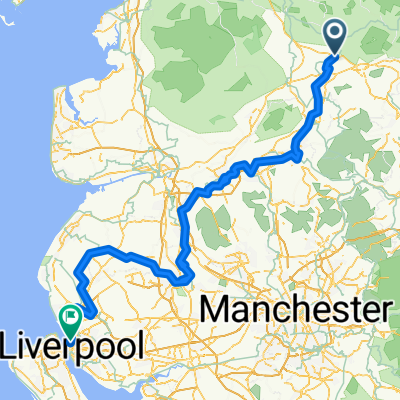
- Route England/Scotland day 4
- Distance
- 103.9 km
- Ascent
- 883 m
- Descent
- 1,028 m
- Location
- Gargrave, England, United Kingdom
- "Gargrave & Slaidburn" w/o Slaidburn
- Distance
- 58.3 km
- Ascent
- 501 m
- Descent
- 501 m
- Location
- Gargrave, England, United Kingdom
- Way of the Roses(3)
- Distance
- 66.4 km
- Ascent
- 486 m
- Descent
- 641 m
- Location
- Gargrave, England, United Kingdom
- Gargrave The Final Rourt
- Distance
- 51.6 km
- Ascent
- 540 m
- Descent
- 540 m
- Location
- Gargrave, England, United Kingdom
Open it in the app