Car Classic am Kuhdamm
Car Classic auf dem Kuhdamm
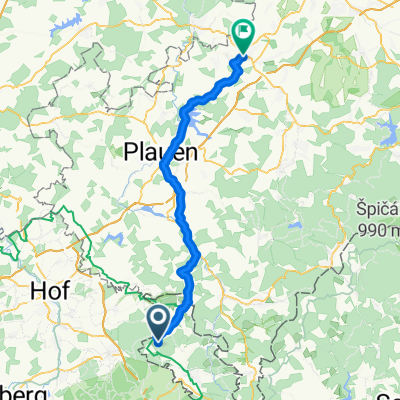
- 278.5 km
- 303 m
- 886 m
- Hranice, Karlovarský kraj, Czechia
A cycling route starting in Hranice, Karlovarský kraj, Czechia.
Overview
created this 10 years ago
Route highlights


parcul Crangasi
Continue with Bikemap
You would like to ride Recording from 17:44, 18 iulie or customize it for your own trip? Here is what you can do with this Bikemap route:
Free trial for 3 days, or one-time payment. More about Bikemap Premium.
Discover more Premium features.
Get Bikemap PremiumFrom our community
Open it in the app