

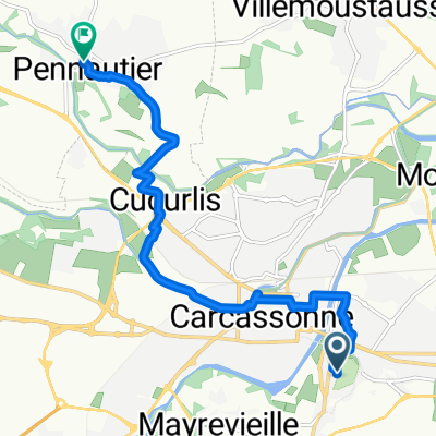
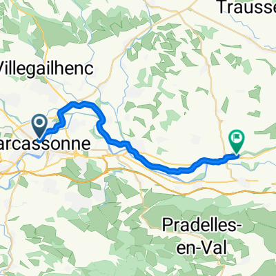
Carcassonne-camping le Canigou
A cycling route starting in Carcassonne, Occitanie, France.
Overview
About this route
Van Carcassonne Airport naar campin le Canigou
- -:--
- Duration
- 129.8 km
- Distance
- 1,103 m
- Ascent
- 928 m
- Descent
- ---
- Avg. speed
- ---
- Max. altitude
Route quality
Waytypes & surfaces along the route
Waytypes
Road
50.6 km
(39 %)
Quiet road
28.6 km
(22 %)
Surfaces
Paved
48 km
(37 %)
Unpaved
3.9 km
(3 %)
Asphalt
48 km
(37 %)
Gravel
3.9 km
(3 %)
Undefined
77.9 km
(60 %)
Continue with Bikemap
Use, edit, or download this cycling route
You would like to ride Carcassonne-camping le Canigou or customize it for your own trip? Here is what you can do with this Bikemap route:
Free features
- Save this route as favorite or in collections
- Copy & plan your own version of this route
- Split it into stages to create a multi-day tour
- Sync your route with Garmin or Wahoo
Premium features
Free trial for 3 days, or one-time payment. More about Bikemap Premium.
- Navigate this route on iOS & Android
- Export a GPX / KML file of this route
- Create your custom printout (try it for free)
- Download this route for offline navigation
Discover more Premium features.
Get Bikemap PremiumFrom our community
Other popular routes starting in Carcassonne
 Carcassonne zur Maison de la la Truffé und Canal du Midi retour
- Distance
- 56 km
- Ascent
- 375 m
- Descent
- 421 m
- Location
- Carcassonne, Occitanie, France
 13.10.25 Carcassonne Homps
- Distance
- 50 km
- Ascent
- 94 m
- Descent
- 199 m
- Location
- Carcassonne, Occitanie, France
 EV3.3 Carcassonne-Narbonne
- Distance
- 113.9 km
- Ascent
- 31 m
- Descent
- 181 m
- Location
- Carcassonne, Occitanie, France
 Allez - retour : Carca - Trébes par Canal du Midi
- Distance
- 25.2 km
- Ascent
- 43 m
- Descent
- 45 m
- Location
- Carcassonne, Occitanie, France
 Rue du Four Saint-Nazaire, Carcassonne to Boulevard Pasteur, Pennautier
- Distance
- 9.8 km
- Ascent
- 84 m
- Descent
- 120 m
- Location
- Carcassonne, Occitanie, France
 Rue du Plo, Carcassonne to Impasse Condorcet, Argeliers
- Distance
- 71.3 km
- Ascent
- 155 m
- Descent
- 260 m
- Location
- Carcassonne, Occitanie, France
 canal_du_midi
- Distance
- 127.7 km
- Ascent
- 59 m
- Descent
- 169 m
- Location
- Carcassonne, Occitanie, France
 Carcassonne / Marseillette
- Distance
- 22.2 km
- Ascent
- 29 m
- Descent
- 64 m
- Location
- Carcassonne, Occitanie, France
Open it in the app