

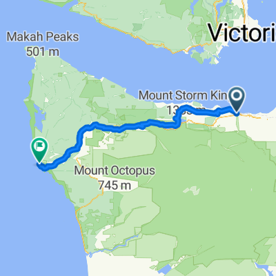
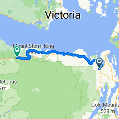
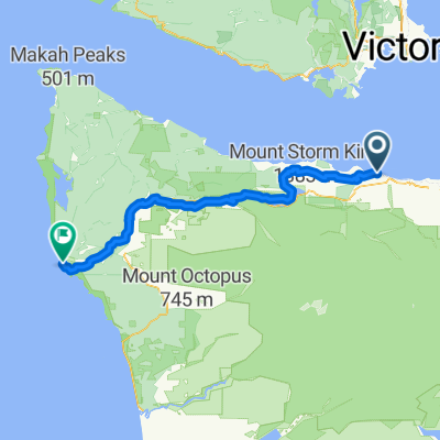
Hurricane Ridge
A cycling route starting in Port Angeles, Washington, United States.
Overview
About this route
From sea-level to the Hurricane Ridge visitors center
- -:--
- Duration
- 31.1 km
- Distance
- 1,612 m
- Ascent
- 36 m
- Descent
- ---
- Avg. speed
- ---
- Max. altitude
Route quality
Waytypes & surfaces along the route
Waytypes
Road
28.6 km
(92 %)
Quiet road
1.9 km
(6 %)
Surfaces
Paved
14.3 km
(46 %)
Asphalt
14.3 km
(46 %)
Undefined
16.8 km
(54 %)
Continue with Bikemap
Use, edit, or download this cycling route
You would like to ride Hurricane Ridge or customize it for your own trip? Here is what you can do with this Bikemap route:
Free features
- Save this route as favorite or in collections
- Copy & plan your own version of this route
- Sync your route with Garmin or Wahoo
Premium features
Free trial for 3 days, or one-time payment. More about Bikemap Premium.
- Navigate this route on iOS & Android
- Export a GPX / KML file of this route
- Create your custom printout (try it for free)
- Download this route for offline navigation
Discover more Premium features.
Get Bikemap PremiumFrom our community
Other popular routes starting in Port Angeles
 la push - port Angeles
- Distance
- 124.6 km
- Ascent
- 2,234 m
- Descent
- 2,258 m
- Location
- Port Angeles, Washington, United States
 East Railroad Avenue to East Railroad Avenue
- Distance
- 34.5 km
- Ascent
- 293 m
- Descent
- 264 m
- Location
- Port Angeles, Washington, United States
 mercredi
- Distance
- 122.5 km
- Ascent
- 2,256 m
- Descent
- 1,938 m
- Location
- Port Angeles, Washington, United States
 National Parks tour
- Distance
- 5,325.1 km
- Ascent
- 10,359 m
- Descent
- 9,109 m
- Location
- Port Angeles, Washington, United States
 Olympic discovery path 2
- Distance
- 125.9 km
- Ascent
- 2,170 m
- Descent
- 2,233 m
- Location
- Port Angeles, Washington, United States
 Eagles Nest to lookout
- Distance
- 16.4 km
- Ascent
- 550 m
- Descent
- 374 m
- Location
- Port Angeles, Washington, United States
 port angeles to kingston
- Distance
- 125.3 km
- Ascent
- 1,884 m
- Descent
- 1,905 m
- Location
- Port Angeles, Washington, United States
 Day 03: Port Angeles to La Conner
- Distance
- 158.2 km
- Ascent
- 1,097 m
- Descent
- 1,077 m
- Location
- Port Angeles, Washington, United States
Open it in the app