
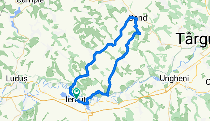
Descopera Transilvania
A cycling route starting in Iernut, Mureș County, Romania.
Overview
About this route
O ruta interesanta care strabate de la sud la nord cateva sate vechi. Veti putea gasi pe traseu atat panorame exceptionale, urcari pe dealuri cat si biserici vechi, unele datatnd din secolul 17-18. Este recomandat sa utilizati o bicicleta MTB, mare parte din traseu fiind drum pietruit sau chiar pamant.
- -:--
- Duration
- 49.6 km
- Distance
- 297 m
- Ascent
- 305 m
- Descent
- ---
- Avg. speed
- ---
- Max. altitude

Route quality
Waytypes & surfaces along the route
Waytypes
Busy road
24.1 km
(49 %)
Road
22 km
(44 %)
Surfaces
Paved
42.5 km
(86 %)
Unpaved
3.2 km
(6 %)
Asphalt
42.5 km
(86 %)
Ground
3 km
(6 %)
Continue with Bikemap
Use, edit, or download this cycling route
You would like to ride Descopera Transilvania or customize it for your own trip? Here is what you can do with this Bikemap route:
Free features
- Save this route as favorite or in collections
- Copy & plan your own version of this route
- Sync your route with Garmin or Wahoo
Premium features
Free trial for 3 days, or one-time payment. More about Bikemap Premium.
- Navigate this route on iOS & Android
- Export a GPX / KML file of this route
- Create your custom printout (try it for free)
- Download this route for offline navigation
Discover more Premium features.
Get Bikemap PremiumFrom our community
Other popular routes starting in Iernut
 Iernut-Cuci
- Distance
- 18.8 km
- Ascent
- 61 m
- Descent
- 63 m
- Location
- Iernut, Mureș County, Romania
 Warm-UP Route
- Distance
- 9.5 km
- Ascent
- 14 m
- Descent
- 19 m
- Location
- Iernut, Mureș County, Romania
 I_N
I_N- Distance
- 41.4 km
- Ascent
- 245 m
- Descent
- 214 m
- Location
- Iernut, Mureș County, Romania
 Spred Out Afternoon Track In Iernut
- Distance
- 18.8 km
- Ascent
- 151 m
- Descent
- 153 m
- Location
- Iernut, Mureș County, Romania
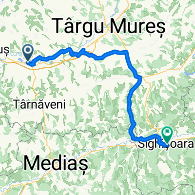 Iernut - Sighisoara ( leg III )
- Distance
- 87.1 km
- Ascent
- 422 m
- Descent
- 352 m
- Location
- Iernut, Mureș County, Romania
 Călatorie in ținutul Târnavelor
- Distance
- 29.2 km
- Ascent
- 388 m
- Descent
- 323 m
- Location
- Iernut, Mureș County, Romania
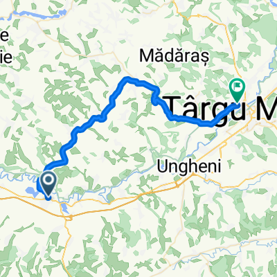
 Iernut-Lechința de Mureș-Dătășeni-Râpa Dateșului-Cuci-Iernut
- Distance
- 20.3 km
- Ascent
- 57 m
- Descent
- 57 m
- Location
- Iernut, Mureș County, Romania
 BG22 Iernut-Cluj
- Distance
- 103.2 km
- Ascent
- 1,158 m
- Descent
- 1,096 m
- Location
- Iernut, Mureș County, Romania
Open it in the app