

Komárka-Fürstenau-Komárka
A cycling route starting in Krupka, Ústecký kraj, Czechia.
Overview
About this route
- -:--
- Duration
- 25.8 km
- Distance
- 333 m
- Ascent
- 379 m
- Descent
- ---
- Avg. speed
- ---
- Max. altitude

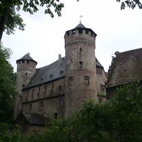
Route photos


Route quality
Waytypes & surfaces along the route
Waytypes
Track
12.1 km
(47 %)
Road
7.2 km
(28 %)
Surfaces
Paved
17.1 km
(66 %)
Unpaved
4.7 km
(18 %)
Asphalt
14.2 km
(55 %)
Paved (undefined)
2.6 km
(10 %)
Continue with Bikemap
Use, edit, or download this cycling route
You would like to ride Komárka-Fürstenau-Komárka or customize it for your own trip? Here is what you can do with this Bikemap route:
Free features
- Save this route as favorite or in collections
- Copy & plan your own version of this route
- Sync your route with Garmin or Wahoo
Premium features
Free trial for 3 days, or one-time payment. More about Bikemap Premium.
- Navigate this route on iOS & Android
- Export a GPX / KML file of this route
- Create your custom printout (try it for free)
- Download this route for offline navigation
Discover more Premium features.
Get Bikemap PremiumFrom our community
Other popular routes starting in Krupka
 Pohraníčí 16.9.2017
- Distance
- 71.4 km
- Ascent
- 697 m
- Descent
- 1,242 m
- Location
- Krupka, Ústecký kraj, Czechia
 Mückenturm
- Distance
- 5.1 km
- Ascent
- 468 m
- Descent
- 15 m
- Location
- Krupka, Ústecký kraj, Czechia
 Komáří Vížka a Krušnými Horami do Mostu
- Distance
- 61.8 km
- Ascent
- 1,143 m
- Descent
- 1,078 m
- Location
- Krupka, Ústecký kraj, Czechia
 2017-11
- Distance
- 39.2 km
- Ascent
- 536 m
- Descent
- 533 m
- Location
- Krupka, Ústecký kraj, Czechia
 Telnice-Cínovec-Výhled Altenberg-Cínovec-sedlo Komárka-Fojtovice-Telnice
- Distance
- 33.2 km
- Ascent
- 339 m
- Descent
- 461 m
- Location
- Krupka, Ústecký kraj, Czechia
 Krupka-Horny Krupka-Komáří Vížka
- Distance
- 5.7 km
- Ascent
- 577 m
- Descent
- 66 m
- Location
- Krupka, Ústecký kraj, Czechia
 Krupka - Mückentürmchen
- Distance
- 6.2 km
- Ascent
- 491 m
- Descent
- 45 m
- Location
- Krupka, Ústecký kraj, Czechia
 Komárka-Fürstenau-Komárka
- Distance
- 25.8 km
- Ascent
- 333 m
- Descent
- 379 m
- Location
- Krupka, Ústecký kraj, Czechia
Open it in the app