


Hummel 1
- 22.1 km
- 542 m
- 541 m
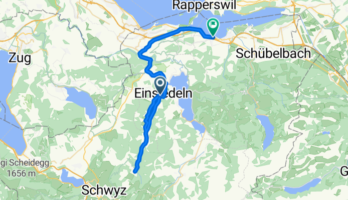
- Einsiedeln, Canton of Schwyz, Switzerland
A cycling route starting in Einsiedeln, Canton of Schwyz, Switzerland.
Overview
Super speed! Departure at dawn with ground fog, arrival at the Mythen at sunrise. During the descent, light precipitation began from Biberbrugg, increasing from Pfäffikon...
created this 16 years ago
Route highlights
Zwischenziel, Start für's Wandern http://www.wandermap.net/route/316215/
Continue with Bikemap
You would like to ride Einsiedeln-Mythen-Altendorf or customize it for your own trip? Here is what you can do with this Bikemap route:
Free trial for 3 days, or one-time payment. More about Bikemap Premium.
Discover more Premium features.
Get Bikemap PremiumFrom our community
Open it in the app


