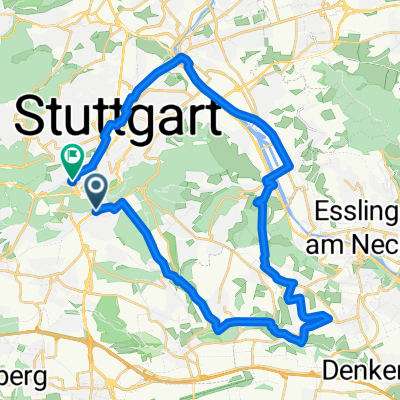
Von Stuttgart nach Obersulm-Willsbach
A cycling route starting in Stuttgart, Baden-Württemberg, Germany.
Overview
About this route
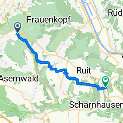
Bis Marbach am Neckar entlang (Neckartalradweg), dann über Steinheim ins Bottwartal einbiegen (Alb-Neckar-Radweg). Zwischen Beilstein und Auenstein ein kleiner Anstieg, zwischen Unterheinriet und Lehrensteinsfeld ein etwas größerer. Im Bottwartal teilweise Schotterwege, gegen Ende teilweise auf der Straße, ansonsten gut ausgebaute Radwege.
- -:--
- Duration
- 63.5 km
- Distance
- 214 m
- Ascent
- 273 m
- Descent
- ---
- Avg. speed
- ---
- Avg. speed
Continue with Bikemap
Use, edit, or download this cycling route
You would like to ride Von Stuttgart nach Obersulm-Willsbach or customize it for your own trip? Here is what you can do with this Bikemap route:
Free features
- Save this route as favorite or in collections
- Copy & plan your own version of this route
- Sync your route with Garmin or Wahoo
Premium features
Free trial for 3 days, or one-time payment. More about Bikemap Premium.
- Navigate this route on iOS & Android
- Export a GPX / KML file of this route
- Create your custom printout (try it for free)
- Download this route for offline navigation
Discover more Premium features.
Get Bikemap PremiumFrom our community
Other popular routes starting in Stuttgart
- siebenmühlentalrunde über plieningen
- Distance
- 37.8 km
- Ascent
- 283 m
- Descent
- 359 m
- Location
- Stuttgart, Baden-Württemberg, Germany
- Hasenbergsteige- Körschtal- Neckartal
- Distance
- 54.9 km
- Ascent
- 402 m
- Descent
- 427 m
- Location
- Stuttgart, Baden-Württemberg, Germany
- kleine Samstagsspaßrunde
- Distance
- 21.3 km
- Ascent
- 431 m
- Descent
- 418 m
- Location
- Stuttgart, Baden-Württemberg, Germany
- Siebenmühlental > Esslingen
- Distance
- 61.5 km
- Ascent
- 347 m
- Descent
- 518 m
- Location
- Stuttgart, Baden-Württemberg, Germany
- Von Stuttgart One-Way 3 Stunden durch den Schönbuch
- Distance
- 51.2 km
- Ascent
- 496 m
- Descent
- 453 m
- Location
- Stuttgart, Baden-Württemberg, Germany
- SWest-Birkenkopf-Bärensee-Solitude
- Distance
- 31.6 km
- Ascent
- 555 m
- Descent
- 555 m
- Location
- Stuttgart, Baden-Württemberg, Germany
- Rund um Stuttgart mit Remstal
- Distance
- 85.5 km
- Ascent
- 710 m
- Descent
- 713 m
- Location
- Stuttgart, Baden-Württemberg, Germany
- Hesslach Waldheim Rundtour
- Distance
- 18.7 km
- Ascent
- 414 m
- Descent
- 416 m
- Location
- Stuttgart, Baden-Württemberg, Germany
Open it in the app