

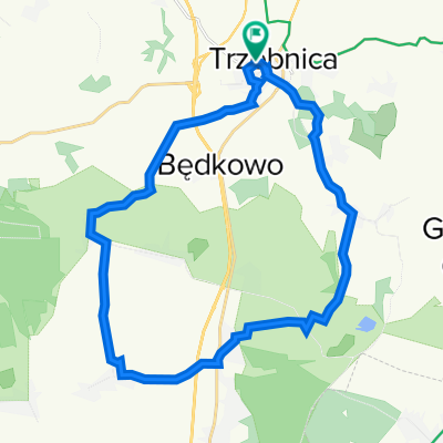
Trzebnica-Dolina Baryczy
A cycling route starting in Trzebnica, Lower Silesian Voivodeship, Poland.
Overview
About this route
Ride from S.Ś.
- -:--
- Duration
- 102.1 km
- Distance
- 213 m
- Ascent
- 213 m
- Descent
- ---
- Avg. speed
- ---
- Max. altitude

Route quality
Waytypes & surfaces along the route
Waytypes
Road
33.7 km
(33 %)
Quiet road
26.6 km
(26 %)
Surfaces
Paved
53.1 km
(52 %)
Unpaved
17.4 km
(17 %)
Asphalt
44.9 km
(44 %)
Gravel
10.2 km
(10 %)
Continue with Bikemap
Use, edit, or download this cycling route
You would like to ride Trzebnica-Dolina Baryczy or customize it for your own trip? Here is what you can do with this Bikemap route:
Free features
- Save this route as favorite or in collections
- Copy & plan your own version of this route
- Split it into stages to create a multi-day tour
- Sync your route with Garmin or Wahoo
Premium features
Free trial for 3 days, or one-time payment. More about Bikemap Premium.
- Navigate this route on iOS & Android
- Export a GPX / KML file of this route
- Create your custom printout (try it for free)
- Download this route for offline navigation
Discover more Premium features.
Get Bikemap PremiumFrom our community
Other popular routes starting in Trzebnica
 Trzebnica Brochocin Milocin Psary Wroclaw Morska
- Distance
- 34.3 km
- Ascent
- 105 m
- Descent
- 185 m
- Location
- Trzebnica, Lower Silesian Voivodeship, Poland
 Trzebnica wersja I
- Distance
- 17.5 km
- Ascent
- 198 m
- Descent
- 200 m
- Location
- Trzebnica, Lower Silesian Voivodeship, Poland
 Tęczowa 2, Zawonia do Spokojna 15, Zawonia
- Distance
- 15.3 km
- Ascent
- 158 m
- Descent
- 163 m
- Location
- Trzebnica, Lower Silesian Voivodeship, Poland
 Wysoki Kościół 1
- Distance
- 23.7 km
- Ascent
- 229 m
- Descent
- 228 m
- Location
- Trzebnica, Lower Silesian Voivodeship, Poland
 Trzebnica-Dolina Baryczy
- Distance
- 102.1 km
- Ascent
- 213 m
- Descent
- 213 m
- Location
- Trzebnica, Lower Silesian Voivodeship, Poland
 Miłocin Głuchów Machnice Trzebnica pętla
- Distance
- 32.4 km
- Ascent
- 277 m
- Descent
- 252 m
- Location
- Trzebnica, Lower Silesian Voivodeship, Poland
 Trzebnica - Prababka
- Distance
- 23 km
- Ascent
- 241 m
- Descent
- 240 m
- Location
- Trzebnica, Lower Silesian Voivodeship, Poland
 Trzebnica Kuraszkow Oborniki Trzebnica
- Distance
- 33.7 km
- Ascent
- 316 m
- Descent
- 317 m
- Location
- Trzebnica, Lower Silesian Voivodeship, Poland
Open it in the app