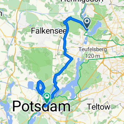
wannseetour
A cycling route starting in Konradshöhe, State of Berlin, Germany.
Overview
About this route
from Tegel to Peacock Island via Spandau back to Tegel
- -:--
- Duration
- 63.7 km
- Distance
- 230 m
- Ascent
- 232 m
- Descent
- ---
- Avg. speed
- ---
- Max. altitude
Route quality
Waytypes & surfaces along the route
Waytypes
Road
15.3 km
(24 %)
Quiet road
12.1 km
(19 %)
Surfaces
Paved
51.6 km
(81 %)
Unpaved
4.5 km
(7 %)
Asphalt
47.1 km
(74 %)
Concrete
4.5 km
(7 %)
Continue with Bikemap
Use, edit, or download this cycling route
You would like to ride wannseetour or customize it for your own trip? Here is what you can do with this Bikemap route:
Free features
- Save this route as favorite or in collections
- Copy & plan your own version of this route
- Sync your route with Garmin or Wahoo
Premium features
Free trial for 3 days, or one-time payment. More about Bikemap Premium.
- Navigate this route on iOS & Android
- Export a GPX / KML file of this route
- Create your custom printout (try it for free)
- Download this route for offline navigation
Discover more Premium features.
Get Bikemap PremiumFrom our community
Other popular routes starting in Konradshöhe
- Tegeler Forst - Stolpe
- Distance
- 37.9 km
- Ascent
- 97 m
- Descent
- 98 m
- Location
- Konradshöhe, State of Berlin, Germany
- Radtour Rügen
- Distance
- 295.9 km
- Ascent
- 274 m
- Descent
- 289 m
- Location
- Konradshöhe, State of Berlin, Germany
- Havelkanalrunde 45km
- Distance
- 44.9 km
- Ascent
- 101 m
- Descent
- 93 m
- Location
- Konradshöhe, State of Berlin, Germany
- tegelort wald
- Distance
- 3.8 km
- Ascent
- 57 m
- Descent
- 57 m
- Location
- Konradshöhe, State of Berlin, Germany
- D - Berlin-Werbellinsee
- Distance
- 196.7 km
- Ascent
- 282 m
- Descent
- 282 m
- Location
- Konradshöhe, State of Berlin, Germany
- Spechtstraße 8, Berlin nach Turmfalkenstraße 41, Berlin
- Distance
- 30.7 km
- Ascent
- 516 m
- Descent
- 557 m
- Location
- Konradshöhe, State of Berlin, Germany
- Havelkanalrunde 30km
- Distance
- 29 km
- Ascent
- 32 m
- Descent
- 24 m
- Location
- Konradshöhe, State of Berlin, Germany
- wannseetour
- Distance
- 63.7 km
- Ascent
- 230 m
- Descent
- 232 m
- Location
- Konradshöhe, State of Berlin, Germany
Open it in the app