

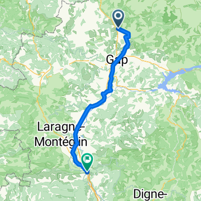
Col du Noyer
A cycling route starting in Saint-Bonnet-en-Champsaur, Provence-Alpes-Côte d'Azur Region, France.
Overview
About this route
Great loop in the Hautes-Alpes
- -:--
- Duration
- 87.2 km
- Distance
- 1,933 m
- Ascent
- 1,933 m
- Descent
- ---
- Avg. speed
- ---
- Max. altitude
Route quality
Waytypes & surfaces along the route
Waytypes
Road
54 km
(62 %)
Quiet road
4.4 km
(5 %)
Surfaces
Paved
22.7 km
(26 %)
Asphalt
22.7 km
(26 %)
Undefined
64.5 km
(74 %)
Route highlights
Points of interest along the route
Point of interest after 40.4 km
Col du Festre
Continue with Bikemap
Use, edit, or download this cycling route
You would like to ride Col du Noyer or customize it for your own trip? Here is what you can do with this Bikemap route:
Free features
- Save this route as favorite or in collections
- Copy & plan your own version of this route
- Split it into stages to create a multi-day tour
- Sync your route with Garmin or Wahoo
Premium features
Free trial for 3 days, or one-time payment. More about Bikemap Premium.
- Navigate this route on iOS & Android
- Export a GPX / KML file of this route
- Create your custom printout (try it for free)
- Download this route for offline navigation
Discover more Premium features.
Get Bikemap PremiumFrom our community
Other popular routes starting in Saint-Bonnet-en-Champsaur
 Chemin du Ga, Saint-Bonnet-en-Champsaur nach Avenue de la Libération, Sisteron
- Distance
- 75.6 km
- Ascent
- 804 m
- Descent
- 1,299 m
- Location
- Saint-Bonnet-en-Champsaur, Provence-Alpes-Côte d'Azur Region, France
 22-12
22-12- Distance
- 78.8 km
- Ascent
- 1,543 m
- Descent
- 2,331 m
- Location
- Saint-Bonnet-en-Champsaur, Provence-Alpes-Côte d'Azur Region, France
 cLo Alpes Tour de Gioberney
- Distance
- 109.5 km
- Ascent
- 1,752 m
- Descent
- 1,752 m
- Location
- Saint-Bonnet-en-Champsaur, Provence-Alpes-Côte d'Azur Region, France
 Stage 19 of 26 Corps - Voiron 113km
- Distance
- 113.6 km
- Ascent
- 1,035 m
- Descent
- 1,446 m
- Location
- Saint-Bonnet-en-Champsaur, Provence-Alpes-Côte d'Azur Region, France
 Jumelage 2015 - étape 3
- Distance
- 156.9 km
- Ascent
- 2,224 m
- Descent
- 2,514 m
- Location
- Saint-Bonnet-en-Champsaur, Provence-Alpes-Côte d'Azur Region, France
 Col du Noyer
- Distance
- 87.2 km
- Ascent
- 1,933 m
- Descent
- 1,933 m
- Location
- Saint-Bonnet-en-Champsaur, Provence-Alpes-Côte d'Azur Region, France
 Grenoble Avignon Gap
- Distance
- 580.5 km
- Ascent
- 4,151 m
- Descent
- 4,375 m
- Location
- Saint-Bonnet-en-Champsaur, Provence-Alpes-Côte d'Azur Region, France
 Col du Noyer
- Distance
- 87.1 km
- Ascent
- 1,920 m
- Descent
- 1,920 m
- Location
- Saint-Bonnet-en-Champsaur, Provence-Alpes-Côte d'Azur Region, France
Open it in the app