

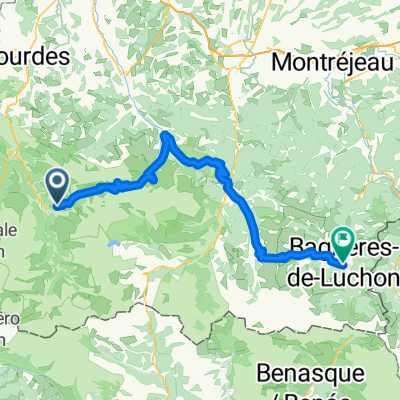
Luz St.- Lac tech- Borderes + Soulor- Luz St.
A cycling route starting in Luz-Saint-Sauveur, Occitanie, France.
Overview
About this route
Luz St Sauveur - Couraduque - Lac teth - Borderes - Argeles - Soulor - Luz St Sauveur
(cloned from route 1332246)
- -:--
- Duration
- 139.8 km
- Distance
- 2,934 m
- Ascent
- 2,939 m
- Descent
- ---
- Avg. speed
- ---
- Max. altitude
Route quality
Waytypes & surfaces along the route
Waytypes
Road
50.3 km
(36 %)
Quiet road
7 km
(5 %)
Surfaces
Paved
100.6 km
(72 %)
Unpaved
1.4 km
(1 %)
Asphalt
100.6 km
(72 %)
Ground
1.4 km
(1 %)
Undefined
37.7 km
(27 %)
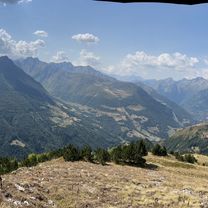
Route highlights
Points of interest along the route
Point of interest after 33.6 km
Couraduque 515m - 6,6 km - 7,8% - 13%
Point of interest after 53.1 km
Lac de Tech 619 m -10.8 km - 5.7 % - 13 %
Point of interest after 66.9 km
Col des Borderes 281 m - 4.3 Km - 6.5 % - 16 %
Point of interest after 102.4 km
Col de Soulor 1052 m - 20.2 km - 5.2% - 17%
Continue with Bikemap
Use, edit, or download this cycling route
You would like to ride Luz St.- Lac tech- Borderes + Soulor- Luz St. or customize it for your own trip? Here is what you can do with this Bikemap route:
Free features
- Save this route as favorite or in collections
- Copy & plan your own version of this route
- Split it into stages to create a multi-day tour
- Sync your route with Garmin or Wahoo
Premium features
Free trial for 3 days, or one-time payment. More about Bikemap Premium.
- Navigate this route on iOS & Android
- Export a GPX / KML file of this route
- Create your custom printout (try it for free)
- Download this route for offline navigation
Discover more Premium features.
Get Bikemap PremiumFrom our community
Other popular routes starting in Luz-Saint-Sauveur
 Pirenaica11. Luz-Saint-Sauveur - Saint-Lary-Soulan
- Distance
- 90.3 km
- Ascent
- 2,819 m
- Descent
- 2,701 m
- Location
- Luz-Saint-Sauveur, Occitanie, France
 Luz St Sauveur
- Distance
- 70.6 km
- Ascent
- 2,448 m
- Descent
- 2,440 m
- Location
- Luz-Saint-Sauveur, Occitanie, France
 tourmalet y col d'aspin
- Distance
- 98.5 km
- Ascent
- 3,201 m
- Descent
- 3,201 m
- Location
- Luz-Saint-Sauveur, Occitanie, France
 Viella to Bagneres-de-Luchon
- Distance
- 91.9 km
- Ascent
- 3,741 m
- Descent
- 3,932 m
- Location
- Luz-Saint-Sauveur, Occitanie, France
 8. Etappe: Luz-Saint-Sauveur - Lauruns
- Distance
- 97 km
- Ascent
- 2,446 m
- Descent
- 2,598 m
- Location
- Luz-Saint-Sauveur, Occitanie, France
 Sers à Chemin des Artigalas, Barèges
- Distance
- 8.2 km
- Ascent
- 304 m
- Descent
- 838 m
- Location
- Luz-Saint-Sauveur, Occitanie, France
 08 Luz Saint Sauveur-Arreau
- Distance
- 58.1 km
- Ascent
- 2,694 m
- Descent
- 3,631 m
- Location
- Luz-Saint-Sauveur, Occitanie, France
 Luz St.- Lac tech- Borderes + Soulor- Luz St.
- Distance
- 139.8 km
- Ascent
- 2,934 m
- Descent
- 2,939 m
- Location
- Luz-Saint-Sauveur, Occitanie, France
Open it in the app