

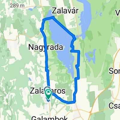
Túra de Karos - Kis-Balaton kör - Mozgunk.hu
A cycling route starting in Zalakomár, Zala County, Hungary.
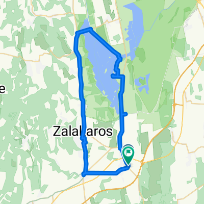
Overview
About this route
Túra de Karos - Kis-Balaton kör - Mozgunk.hu
- -:--
- Duration
- 36.5 km
- Distance
- 97 m
- Ascent
- 95 m
- Descent
- ---
- Avg. speed
- ---
- Max. altitude

Route quality
Waytypes & surfaces along the route
Waytypes
Cycleway
8 km
(22 %)
Quiet road
2.2 km
(6 %)
Surfaces
Paved
31.4 km
(86 %)
Unpaved
1.5 km
(4 %)
Asphalt
31.4 km
(86 %)
Gravel
1.5 km
(4 %)
Undefined
3.7 km
(10 %)
Continue with Bikemap
Use, edit, or download this cycling route
You would like to ride Túra de Karos - Kis-Balaton kör - Mozgunk.hu or customize it for your own trip? Here is what you can do with this Bikemap route:
Free features
- Save this route as favorite or in collections
- Copy & plan your own version of this route
- Sync your route with Garmin or Wahoo
Premium features
Free trial for 3 days, or one-time payment. More about Bikemap Premium.
- Navigate this route on iOS & Android
- Export a GPX / KML file of this route
- Create your custom printout (try it for free)
- Download this route for offline navigation
Discover more Premium features.
Get Bikemap PremiumFrom our community
Other popular routes starting in Zalakomár
 Múlt kor csillagtúra/Hídvég kis erődjéig a
- Distance
- 36.4 km
- Ascent
- 80 m
- Descent
- 83 m
- Location
- Zalakomár, Zala County, Hungary
 Zalakaros - Zalakaros
- Distance
- 36.9 km
- Ascent
- 121 m
- Descent
- 119 m
- Location
- Zalakomár, Zala County, Hungary
 Zalakaros 2
- Distance
- 57.8 km
- Ascent
- 417 m
- Descent
- 415 m
- Location
- Zalakomár, Zala County, Hungary
 Gyógyfürdő tér - Gyógyfürdő tér
- Distance
- 45.7 km
- Ascent
- 147 m
- Descent
- 145 m
- Location
- Zalakomár, Zala County, Hungary
 Mount Everest/Hegytető
- Distance
- 5.2 km
- Ascent
- 124 m
- Descent
- 73 m
- Location
- Zalakomár, Zala County, Hungary
 Zalakaros 1
- Distance
- 77.1 km
- Ascent
- 159 m
- Descent
- 159 m
- Location
- Zalakomár, Zala County, Hungary
 Kis-balatoni turzás II. túra himbákkal és lokátorral
- Distance
- 7.5 km
- Ascent
- 30 m
- Descent
- 33 m
- Location
- Zalakomár, Zala County, Hungary
 68351-es mellékút, Zalakomár - Zalakomár
- Distance
- 44.2 km
- Ascent
- 169 m
- Descent
- 171 m
- Location
- Zalakomár, Zala County, Hungary
Open it in the app