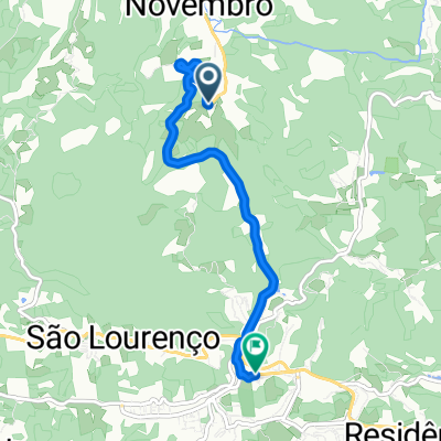
Pedra Paulista MTB
A cycling route starting in Santa Teresa, Espírito Santo, Brazil.
Overview
About this route
explorando a Pedra Paulista
- -:--
- Duration
- 57.3 km
- Distance
- 1,204 m
- Ascent
- 1,204 m
- Descent
- ---
- Avg. speed
- ---
- Max. altitude
Route highlights
Points of interest along the route
Point of interest after 28.6 km
Cume Pedra Paulistadeixar a bikes...
Continue with Bikemap
Use, edit, or download this cycling route
You would like to ride Pedra Paulista MTB or customize it for your own trip? Here is what you can do with this Bikemap route:
Free features
- Save this route as favorite or in collections
- Copy & plan your own version of this route
- Sync your route with Garmin or Wahoo
Premium features
Free trial for 3 days, or one-time payment. More about Bikemap Premium.
- Navigate this route on iOS & Android
- Export a GPX / KML file of this route
- Create your custom printout (try it for free)
- Download this route for offline navigation
Discover more Premium features.
Get Bikemap PremiumFrom our community
Other popular routes starting in Santa Teresa
- PASSEIO CICLISTICO DESCIDA DO CAMINHO DOS COLIBRIS.
- Distance
- 49.5 km
- Ascent
- 378 m
- Descent
- 962 m
- Location
- Santa Teresa, Espírito Santo, Brazil
- III Desafio das Montanhas
- Distance
- 42.1 km
- Ascent
- 784 m
- Descent
- 784 m
- Location
- Santa Teresa, Espírito Santo, Brazil
- Rua Antônio Roatti, 268, Santa Teresa a Avenida José Ruschi, 107–347, Santa Teresa
- Distance
- 7.6 km
- Ascent
- 158 m
- Descent
- 160 m
- Location
- Santa Teresa, Espírito Santo, Brazil
- caminho do Imigrante 1º parte
- Distance
- 30.7 km
- Ascent
- 310 m
- Descent
- 1,082 m
- Location
- Santa Teresa, Espírito Santo, Brazil
- PASSEIO MTB CAMINHO DOS COLIBRIS, SANTA TERESA -ES X JOÃO NEIVA -ES
- Distance
- 43.7 km
- Ascent
- 484 m
- Descent
- 957 m
- Location
- Santa Teresa, Espírito Santo, Brazil
- aquecimento
- Distance
- 5.3 km
- Ascent
- 160 m
- Descent
- 158 m
- Location
- Santa Teresa, Espírito Santo, Brazil
- SEGUNDO DESAFIO DAS MONTANHAS DE SANTA TERESA
- Distance
- 41.3 km
- Ascent
- 785 m
- Descent
- 785 m
- Location
- Santa Teresa, Espírito Santo, Brazil
- Sítio Sol da Vitória X Santa Maria de Jetiba
- Distance
- 21.7 km
- Ascent
- 412 m
- Descent
- 500 m
- Location
- Santa Teresa, Espírito Santo, Brazil
Open it in the app