Mönchwinkel
A cycling route starting in Müggelheim, State of Berlin, Germany.
Overview
About this route
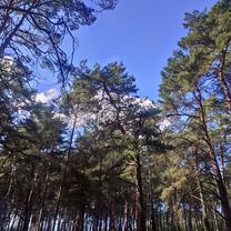
lightly trafficked roads and paved forest paths; forest, fields, meadows, lakes, canal
- -:--
- Duration
- 54.3 km
- Distance
- 130 m
- Ascent
- 127 m
- Descent
- ---
- Avg. speed
- ---
- Max. altitude
Route quality
Waytypes & surfaces along the route
Waytypes
- Quiet road - 18.5 km - (34 %) 
- Track - 13.6 km - (25 %) 
Surfaces
Paved
33.7 km
(62 %)
Unpaved
14.1 km
(26 %)
- Asphalt - 31 km - (57 %) 
- Ground - 5.4 km - (10 %) 
Continue with Bikemap
Use, edit, or download this cycling route
You would like to ride Mönchwinkel or customize it for your own trip? Here is what you can do with this Bikemap route:
Free features
- Save this route as favorite or in collections
- Copy & plan your own version of this route
- Sync your route with Garmin or Wahoo
Premium features
Free trial for 3 days, or one-time payment. More about Bikemap Premium.
- Navigate this route on iOS & Android
- Export a GPX / KML file of this route
- Create your custom printout (try it for free)
- Download this route for offline navigation
Discover more Premium features.
Get Bikemap PremiumFrom our community
Other popular routes starting in Müggelheim
 De Sportpromenade a Marchlewskistraße De Sportpromenade a Marchlewskistraße- Distance
- 20.9 km
- Ascent
- 56 m
- Descent
- 77 m
- Location
- Müggelheim, State of Berlin, Germany
 
 Müggelheim - Hausstrecke Müggelheim - Hausstrecke- Distance
- 11.9 km
- Ascent
- 253 m
- Descent
- 250 m
- Location
- Müggelheim, State of Berlin, Germany
 
 CTF Winterwald CTF Winterwald- Distance
- 34.4 km
- Ascent
- 142 m
- Descent
- 137 m
- Location
- Müggelheim, State of Berlin, Germany
 
 müggelsee groß kreutz müggelsee groß kreutz- Distance
- 82.3 km
- Ascent
- 124 m
- Descent
- 133 m
- Location
- Müggelheim, State of Berlin, Germany
 
 52`er Runde 52`er Runde- Distance
- 52.7 km
- Ascent
- 136 m
- Descent
- 130 m
- Location
- Müggelheim, State of Berlin, Germany
 
 Mönchwinkel Mönchwinkel- Distance
- 54.3 km
- Ascent
- 130 m
- Descent
- 127 m
- Location
- Müggelheim, State of Berlin, Germany
 
 Müggelsee Müggelsee- Distance
- 18.8 km
- Ascent
- 35 m
- Descent
- 36 m
- Location
- Müggelheim, State of Berlin, Germany
 
 WaFa RuB 1 Müggelsee WaFa RuB 1 Müggelsee- Distance
- 30 km
- Ascent
- 36 m
- Descent
- 38 m
- Location
- Müggelheim, State of Berlin, Germany
 
Open it in the app

