

Classique des Vogés
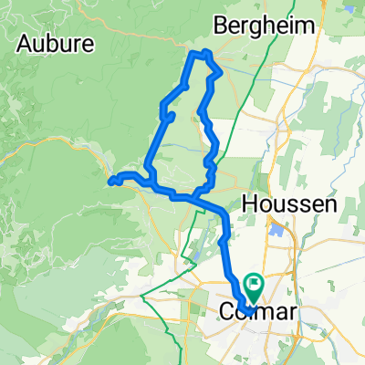
A cycling route starting in Colmar, Grand Est, France.
Overview
About this route
Vogeserne Classic
Firstplan - Petit Ballon - Platzerwaesel - Grand Ballon (Col du Haag) - Bramont - Croix des Moinats - Ménil - Col des Croix - Ballon de Servance - Planche Belles Filles
- -:--
- Duration
- 209.1 km
- Distance
- 4,428 m
- Ascent
- 3,601 m
- Descent
- ---
- Avg. speed
- ---
- Max. altitude

Route quality
Waytypes & surfaces along the route
Waytypes
Road
73.2 km
(35 %)
Quiet road
62.7 km
(30 %)
Surfaces
Paved
98.3 km
(47 %)
Unpaved
6.3 km
(3 %)
Asphalt
98.3 km
(47 %)
Unpaved (undefined)
2.1 km
(1 %)
Route highlights
Points of interest along the route
Point of interest after 25.6 km
Col du Firstplan
Point of interest after 42.7 km
Col de Petit Ballon
Point of interest after 58.6 km
Col du Platzerwaesel
Point of interest after 101.7 km
Col du Haag
Point of interest after 103.3 km
Grand Ballon
Point of interest after 133.7 km
Col d'Oderen
Point of interest after 144.7 km
Col de Bramont
Point of interest after 153 km
Col de Grosse Pierre
Point of interest after 159.6 km
Col de la Croix des Moinats
Point of interest after 159.8 km
Col de Menufosse
Point of interest after 160.5 km
Col des Hayes
Point of interest after 170.1 km
Col du Ménil
Point of interest after 182.1 km
Col des Croix
Point of interest after 192.4 km
Ballon de Servance
Point of interest after 209.1 km
Belles Filles
Continue with Bikemap
Use, edit, or download this cycling route
You would like to ride Classique des Vogés or customize it for your own trip? Here is what you can do with this Bikemap route:
Free features
- Save this route as favorite or in collections
- Copy & plan your own version of this route
- Split it into stages to create a multi-day tour
- Sync your route with Garmin or Wahoo
Premium features
Free trial for 3 days, or one-time payment. More about Bikemap Premium.
- Navigate this route on iOS & Android
- Export a GPX / KML file of this route
- Create your custom printout (try it for free)
- Download this route for offline navigation
Discover more Premium features.
Get Bikemap PremiumFrom our community
Other popular routes starting in Colmar
 Colmar<>Freiburg
- Distance
- 45.7 km
- Ascent
- 140 m
- Descent
- 49 m
- Location
- Colmar, Grand Est, France
 Rue du Rempart, Colmar to Rue du Rempart, Colmar
- Distance
- 38.8 km
- Ascent
- 409 m
- Descent
- 410 m
- Location
- Colmar, Grand Est, France
 4. Sélestat - Strasbourg
- Distance
- 16.8 km
- Ascent
- 169 m
- Descent
- 55 m
- Location
- Colmar, Grand Est, France
 Etappe 14 Tour de France 2009 von Colmar nach Besançon
- Distance
- 202.5 km
- Ascent
- 1,131 m
- Descent
- 1,003 m
- Location
- Colmar, Grand Est, France
 Rue Saint-Léon, Colmar à Rue Saint-Léon, Colmar
- Distance
- 59.8 km
- Ascent
- 132 m
- Descent
- 134 m
- Location
- Colmar, Grand Est, France
 Route nach Colmar
- Distance
- 47 km
- Ascent
- 370 m
- Descent
- 365 m
- Location
- Colmar, Grand Est, France
 Rue du Rempart, Colmar to Rue du Rempart, Colmar
- Distance
- 44.2 km
- Ascent
- 450 m
- Descent
- 452 m
- Location
- Colmar, Grand Est, France
 Golmar
- Distance
- 48.2 km
- Ascent
- 684 m
- Descent
- 685 m
- Location
- Colmar, Grand Est, France
Open it in the app