

Over the River 'N through the 'Wood 2016
A cycling route starting in Englewood, Ohio, United States.
Overview
About this route
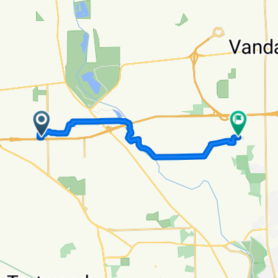
Route begins @Centennial Park, Englewood OH takes the bike route South through residential area to Wenger Road. Riders go West to Crestway, then South to Kimmel. Follow Kimmel West to Wastler crossing Diamond Mill onto East Upper Salem to Wellbaum and North to Wengerlawn. Next Riders go West on Wengerlawn to Brookville-Phillipsburg Road Where they go North To East Main in Phillipsburg. (Note: 1st break area will be at Brookville Community Park just before reaching E. Main) Next riders will go East on Phillipsburg-Union to Pansing, then North to Frederick-Garland, East across SR48 and the Still Water River to Ballinger which becomes Old Springfield West becoming Phillipsburg-Union once crossing SR48. Continue West to Putnam, South to Sweet Potato Ridge, West to Barnes and South to National Road. From here Riders will go East rejoining the bike route at Hoke Rd and returning to Centennial Park.
- -:--
- Duration
- 48.1 km
- Distance
- 137 m
- Ascent
- 136 m
- Descent
- ---
- Avg. speed
- ---
- Max. altitude
Route quality
Waytypes & surfaces along the route
Waytypes
Quiet road
18.5 km
(38 %)
Road
18.2 km
(38 %)
Surfaces
Paved
1 km
(2 %)
Asphalt
1 km
(2 %)
Undefined
47.1 km
(98 %)
Continue with Bikemap
Use, edit, or download this cycling route
You would like to ride Over the River 'N through the 'Wood 2016 or customize it for your own trip? Here is what you can do with this Bikemap route:
Free features
- Save this route as favorite or in collections
- Copy & plan your own version of this route
- Sync your route with Garmin or Wahoo
Premium features
Free trial for 3 days, or one-time payment. More about Bikemap Premium.
- Navigate this route on iOS & Android
- Export a GPX / KML file of this route
- Create your custom printout (try it for free)
- Download this route for offline navigation
Discover more Premium features.
Get Bikemap PremiumFrom our community
Other popular routes starting in Englewood
 Over the River 'N through the 'Wood 2016
- Distance
- 48.1 km
- Ascent
- 137 m
- Descent
- 136 m
- Location
- Englewood, Ohio, United States
 Overla Boulevard 621, Englewood to Browning Avenue 790, Englewood
- Distance
- 9.5 km
- Ascent
- 0 m
- Descent
- 3 m
- Location
- Englewood, Ohio, United States
 Pattys Road, Vandalia to Pattys Road, Vandalia
- Distance
- 8.9 km
- Ascent
- 104 m
- Descent
- 105 m
- Location
- Englewood, Ohio, United States
 Moderate route in Vandalia
- Distance
- 38.4 km
- Ascent
- 272 m
- Descent
- 217 m
- Location
- Englewood, Ohio, United States
 1236 Sunset Dr, Englewood to 3462 Garianne Dr, Dayton
- Distance
- 11.5 km
- Ascent
- 100 m
- Descent
- 96 m
- Location
- Englewood, Ohio, United States
 1232 Sunset Dr, Englewood to 3462 Garianne Dr, Dayton
- Distance
- 11.5 km
- Ascent
- 102 m
- Descent
- 101 m
- Location
- Englewood, Ohio, United States
 Kinsey Road 7119, Englewood to Kinsey Road 7119, Englewood
- Distance
- 8.8 km
- Ascent
- 21 m
- Descent
- 26 m
- Location
- Englewood, Ohio, United States
 Kinsey Road 7119, Englewood to Kinsey Road 7119, Englewood
- Distance
- 2.6 km
- Ascent
- 22 m
- Descent
- 21 m
- Location
- Englewood, Ohio, United States
Open it in the app