

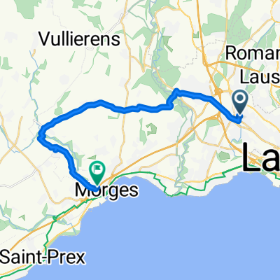
Renens - Montrichier - Neuchatel - Renens V1
A cycling route starting in Renens, Canton of Vaud, Switzerland.
Overview
About this route
v1 no description
- -:--
- Duration
- 204 km
- Distance
- 2,532 m
- Ascent
- 2,452 m
- Descent
- ---
- Avg. speed
- ---
- Max. altitude
Route highlights
Points of interest along the route
Point of interest after 153.9 km
Camping
Point of interest after 158.8 km
CAMPING
Continue with Bikemap
Use, edit, or download this cycling route
You would like to ride Renens - Montrichier - Neuchatel - Renens V1 or customize it for your own trip? Here is what you can do with this Bikemap route:
Free features
- Save this route as favorite or in collections
- Copy & plan your own version of this route
- Split it into stages to create a multi-day tour
- Sync your route with Garmin or Wahoo
Premium features
Free trial for 3 days, or one-time payment. More about Bikemap Premium.
- Navigate this route on iOS & Android
- Export a GPX / KML file of this route
- Create your custom printout (try it for free)
- Download this route for offline navigation
Discover more Premium features.
Get Bikemap PremiumFrom our community
Other popular routes starting in Renens
 De Chemin Mont Robert 4, Renens VD à Sur la Croix 12, Renens VD
- Distance
- 118.9 km
- Ascent
- 1,169 m
- Descent
- 1,172 m
- Location
- Renens, Canton of Vaud, Switzerland
 La Cure à Boulangerie Goumoens
- Distance
- 15.3 km
- Ascent
- 215 m
- Descent
- 96 m
- Location
- Renens, Canton of Vaud, Switzerland
 Bussigny chemin des 3 refuges
- Distance
- 22.1 km
- Ascent
- 226 m
- Descent
- 226 m
- Location
- Renens, Canton of Vaud, Switzerland
 Renens - Montrichier - Neuchatel - Renens V1
- Distance
- 204 km
- Ascent
- 2,532 m
- Descent
- 2,452 m
- Location
- Renens, Canton of Vaud, Switzerland
 Rue de Lausanne 60, Renens VD nach Chemin de la Colice 22, Crissier
- Distance
- 4.5 km
- Ascent
- 81 m
- Descent
- 40 m
- Location
- Renens, Canton of Vaud, Switzerland
 La Cure à Manège Bottens
- Distance
- 13 km
- Ascent
- 343 m
- Descent
- 108 m
- Location
- Renens, Canton of Vaud, Switzerland
 Renens-Vufflens via St-Saph.
- Distance
- 16 km
- Ascent
- 195 m
- Descent
- 243 m
- Location
- Renens, Canton of Vaud, Switzerland
 Lunch ride
- Distance
- 33.1 km
- Ascent
- 383 m
- Descent
- 383 m
- Location
- Renens, Canton of Vaud, Switzerland
Open it in the app