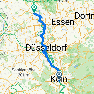
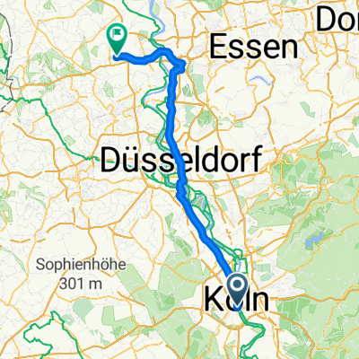
KEV Wanderheim Bugelaul
A cycling route starting in Altstadt Sud, North Rhine-Westphalia, Germany.
Overview
About this route
Wanderheim Bugelaul
from Köln Pegel to Bugelaul 50Km
- -:--
- Duration
- 51.4 km
- Distance
- 73 m
- Ascent
- 41 m
- Descent
- ---
- Avg. speed
- ---
- Max. altitude
Route quality
Waytypes & surfaces along the route
Waytypes
Path
25.7 km
(50 %)
Quiet road
14.4 km
(28 %)
Surfaces
Paved
37 km
(72 %)
Unpaved
6.7 km
(13 %)
Asphalt
35 km
(68 %)
Loose gravel
4.1 km
(8 %)
Route highlights
Points of interest along the route

Photo after 24.7 km
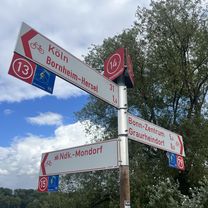
Einkaufszentrum troisdorf

Photo after 26.6 km
AGGUA TROISDORF Das Wohlfühlzentrum für Körper und Sinne Aggerdamm 22 53840 Troisdorf Tel. 02241-9845-0

Accommodation after 40.7 km
Hennef Bahnhof Hennefer Wirtshaus Bahnhofstr. 19 53773 Hennef Telefonisch: Tel.: 0 22 42 / 8 73 03 07 Öffnungszeiten: taglich ab 11:30 Uhr
Point of interest after 48.6 km
Über die Bahnlinie Knopf drücken um die Schranken zu Höffnen
Point of interest after 51.4 km
Merten (Sieg) Bahnhof
Continue with Bikemap
Use, edit, or download this cycling route
You would like to ride KEV Wanderheim Bugelaul or customize it for your own trip? Here is what you can do with this Bikemap route:
Free features
- Save this route as favorite or in collections
- Copy & plan your own version of this route
- Sync your route with Garmin or Wahoo
Premium features
Free trial for 3 days, or one-time payment. More about Bikemap Premium.
- Navigate this route on iOS & Android
- Export a GPX / KML file of this route
- Create your custom printout (try it for free)
- Download this route for offline navigation
Discover more Premium features.
Get Bikemap PremiumFrom our community
Other popular routes starting in Altstadt Sud
KEV Wanderheim Bugelaul- Distance
- 51.4 km
- Ascent
- 73 m
- Descent
- 41 m
- Location
- Altstadt Sud, North Rhine-Westphalia, Germany
auf den Spuren des preußischen Kölns – im Rechtsrheinischen- Distance
- 34.2 km
- Ascent
- 88 m
- Descent
- 100 m
- Location
- Altstadt Sud, North Rhine-Westphalia, Germany
Rund um Köln 2010- Distance
- 67.2 km
- Ascent
- 488 m
- Descent
- 482 m
- Location
- Altstadt Sud, North Rhine-Westphalia, Germany
Frankenwerft, Köln nach Richard-Wagner-Straße, Bonn- Distance
- 38.1 km
- Ascent
- 167 m
- Descent
- 160 m
- Location
- Altstadt Sud, North Rhine-Westphalia, Germany
Einmal ummen Airport- Distance
- 50.4 km
- Ascent
- 130 m
- Descent
- 131 m
- Location
- Altstadt Sud, North Rhine-Westphalia, Germany
RuK 2010- Distance
- 69.1 km
- Ascent
- 366 m
- Descent
- 366 m
- Location
- Altstadt Sud, North Rhine-Westphalia, Germany
Kölner Botanischer-Gärten- Distance
- 34 km
- Ascent
- 80 m
- Descent
- 79 m
- Location
- Altstadt Sud, North Rhine-Westphalia, Germany
Köln - Rheinberg- Distance
- 100.4 km
- Ascent
- 265 m
- Descent
- 289 m
- Location
- Altstadt Sud, North Rhine-Westphalia, Germany
Open it in the app


