34_Von Donauwörth nach Ingolstadt
A cycling route starting in Donauwörth, Bavaria, Germany.
Overview
About this route
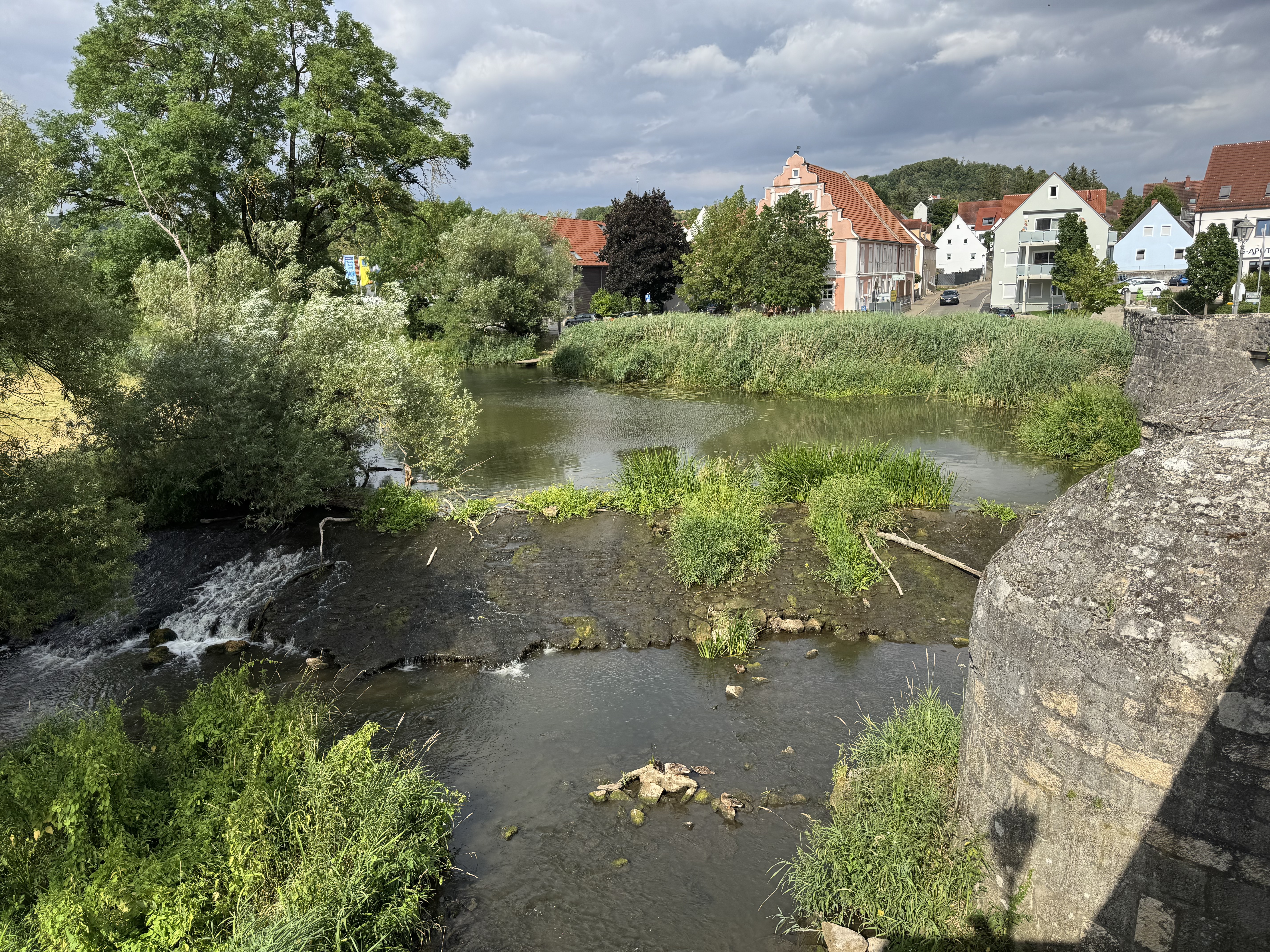
Von Stadttor zu Stadttor und von Schloss zu Schloss Charakter: Auwälder und flaches Gelände charakterisieren diese Etappe. Wir radeln auf gekiesten Wegen durch Auwälder und auf asphaltierten schmalen Straßen bzw. Radwegen. Verkehr: Bei den Ortsdurchfahrten in Günzburg, Gundelfingen, Dillingen und Höchstädt ist mit Verkehr zu rechnen. Die Straße nach Rettingen ist schmal und ohne Radweg. Passender Reiseführer: KOMPASS 6464 Donauradweg 1, Ralf Enke, ISBN 978-3-85026-653-6
- -:--
- Duration
- 59.9 km
- Distance
- 165 m
- Ascent
- 205 m
- Descent
- ---
- Avg. speed
- ---
- Max. altitude
Route quality
Waytypes & surfaces along the route
Waytypes
- Track - 20.4 km - (34 %) 
- Quiet road - 16.2 km - (27 %) 
Surfaces
Paved
37.2 km
(62 %)
Unpaved
18 km
(30 %)
- Asphalt - 34.8 km - (58 %) 
- Gravel - 15 km - (25 %) 
Route highlights
Points of interest along the route
 - Point of interest after 36.2 km- 
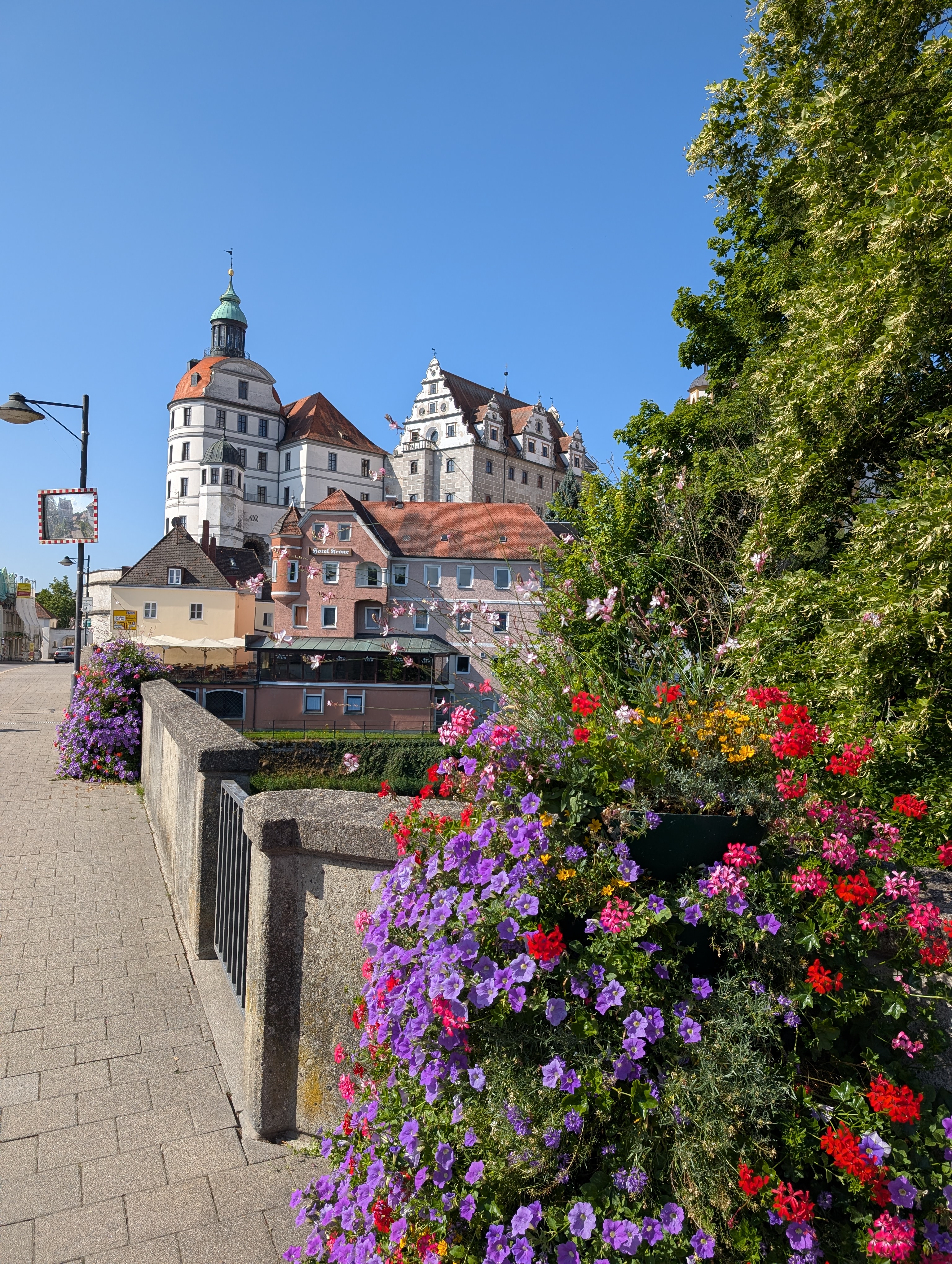
Neuburg: 798 wird die Pfalz mit der Marienkapelle in einer Urkunde erwähnt. Die angrenzende Siedlung wurde als „civitas nova“ bezeichnet. Gegenüber, an der Westseite des Stadtberges, wird die Pfarrkirche St. Peter errichtet, die Ausgangspunkt des Bistums und Klosters war. Ab 1392 gehörte Neuburg zum 
 - Point of interest after 59.2 km- Ingolstadt: Als „villa Ingoldesstat“ wird Ingolstadt in der Reichsteilungsurkunde Karls des Großen geführt. Im Jahre 841 wird „Ingoldesstat“ dem Kloster Niederaltaich geschenkt. In den folgenden 400 Jahren fehlen Aufzeichnungen über Ingolstadt. 1242 erbten die Wittelsbacher die Herrschaft. Mit der E 
Continue with Bikemap
Use, edit, or download this cycling route
You would like to ride 34_Von Donauwörth nach Ingolstadt or customize it for your own trip? Here is what you can do with this Bikemap route:
Free features
- Save this route as favorite or in collections
- Copy & plan your own version of this route
- Sync your route with Garmin or Wahoo
Premium features
Free trial for 3 days, or one-time payment. More about Bikemap Premium.
- Navigate this route on iOS & Android
- Export a GPX / KML file of this route
- Create your custom printout (try it for free)
- Download this route for offline navigation
Discover more Premium features.
Get Bikemap PremiumFrom our community
Other popular routes starting in Donauwörth
 Donauwurth - Kelheim Donauwurth - Kelheim- Distance
- 116.7 km
- Ascent
- 751 m
- Descent
- 805 m
- Location
- Donauwörth, Bavaria, Germany
 
 Kesseltalrunde 4.7.12 Kesseltalrunde 4.7.12- Distance
- 45.6 km
- Ascent
- 290 m
- Descent
- 290 m
- Location
- Donauwörth, Bavaria, Germany
 
 E6. 10.7.25 Donauwörth nach Ingolstadt E6. 10.7.25 Donauwörth nach Ingolstadt- Distance
- 78.1 km
- Ascent
- 245 m
- Descent
- 332 m
- Location
- Donauwörth, Bavaria, Germany
 
 Hindenburgstraße, Donauwörth to Baldinger Straße, Nördlingen Hindenburgstraße, Donauwörth to Baldinger Straße, Nördlingen- Distance
- 35.7 km
- Ascent
- 190 m
- Descent
- 161 m
- Location
- Donauwörth, Bavaria, Germany
 
 Bahnhofstraße, Donauwörth to Mündlinger Straße, Harburg Bahnhofstraße, Donauwörth to Mündlinger Straße, Harburg- Distance
- 15.5 km
- Ascent
- 136 m
- Descent
- 109 m
- Location
- Donauwörth, Bavaria, Germany
 
 SARadwag SARadwag- Distance
- 422.6 km
- Ascent
- 6,973 m
- Descent
- 6,977 m
- Location
- Donauwörth, Bavaria, Germany
 
 Trans-Alp Via Claudia Augusta Donauwörth bis Torbole am Gardasee Trans-Alp Via Claudia Augusta Donauwörth bis Torbole am Gardasee- Distance
- 515.6 km
- Ascent
- 1,830 m
- Descent
- 2,159 m
- Location
- Donauwörth, Bavaria, Germany
 
 Parkstadtrail Parkstadtrail- Distance
- 1.2 km
- Ascent
- 61 m
- Descent
- 60 m
- Location
- Donauwörth, Bavaria, Germany
 
Open it in the app

