
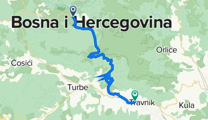
VLASIC montagna - TRAVNIK
A cycling route starting in Turbe, Federation of Bosnia and Herzegovina, Bosnia and Herzegovina.
Overview
About this route
Mountain stage from Vlasic, a winter sports center, takes you under the peaks of Vlasic and Kotol towards the valley. The descent at the end has a drop of 970 m... before arriving in the city of Travnik.
- -:--
- Duration
- 26.5 km
- Distance
- 404 m
- Ascent
- 1,135 m
- Descent
- ---
- Avg. speed
- ---
- Max. altitude
Route quality
Waytypes & surfaces along the route
Waytypes
Road
1.3 km
(5 %)
Quiet road
0.8 km
(3 %)
Undefined
24.4 km
(92 %)
Surfaces
Paved
25.7 km
(97 %)
Asphalt
25.7 km
(97 %)
Undefined
0.8 km
(3 %)
Continue with Bikemap
Use, edit, or download this cycling route
You would like to ride VLASIC montagna - TRAVNIK or customize it for your own trip? Here is what you can do with this Bikemap route:
Free features
- Save this route as favorite or in collections
- Copy & plan your own version of this route
- Sync your route with Garmin or Wahoo
Premium features
Free trial for 3 days, or one-time payment. More about Bikemap Premium.
- Navigate this route on iOS & Android
- Export a GPX / KML file of this route
- Create your custom printout (try it for free)
- Download this route for offline navigation
Discover more Premium features.
Get Bikemap PremiumFrom our community
Other popular routes starting in Turbe
 VLASIC montagna - TRAVNIK
- Distance
- 26.5 km
- Ascent
- 404 m
- Descent
- 1,135 m
- Location
- Turbe, Federation of Bosnia and Herzegovina, Bosnia and Herzegovina
 Vlašić XCM - Mala
- Distance
- 26.7 km
- Ascent
- 641 m
- Descent
- 640 m
- Location
- Turbe, Federation of Bosnia and Herzegovina, Bosnia and Herzegovina
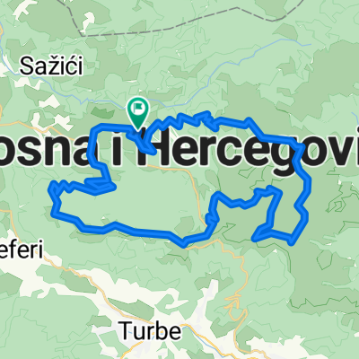 Vlašić kružno
- Distance
- 43.3 km
- Ascent
- 1,049 m
- Descent
- 1,049 m
- Location
- Turbe, Federation of Bosnia and Herzegovina, Bosnia and Herzegovina
 Šešićka Planina
- Distance
- 22.8 km
- Ascent
- 621 m
- Descent
- 620 m
- Location
- Turbe, Federation of Bosnia and Herzegovina, Bosnia and Herzegovina
 VLASIC -PROVA
- Distance
- 31.5 km
- Ascent
- 523 m
- Descent
- 1,257 m
- Location
- Turbe, Federation of Bosnia and Herzegovina, Bosnia and Herzegovina
 Babanovac Tesanj
- Distance
- 113 km
- Ascent
- 1,776 m
- Descent
- 2,802 m
- Location
- Turbe, Federation of Bosnia and Herzegovina, Bosnia and Herzegovina
 Vodopad ugar
- Distance
- 8.8 km
- Ascent
- 377 m
- Descent
- 427 m
- Location
- Turbe, Federation of Bosnia and Herzegovina, Bosnia and Herzegovina
 MONTAGNE DI VLASIC - TRAVNIK
- Distance
- 23 km
- Ascent
- 290 m
- Descent
- 995 m
- Location
- Turbe, Federation of Bosnia and Herzegovina, Bosnia and Herzegovina
Open it in the app