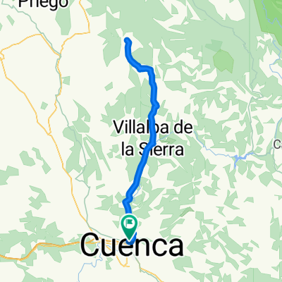
Cuenca (Bosque de Acero) - Alto de la Muela
A cycling route starting in Cuenca, Castille-La Mancha, Spain.
Overview
About this route
.
- -:--
- Duration
- 182.1 km
- Distance
- 2,771 m
- Ascent
- 1,884 m
- Descent
- ---
- Avg. speed
- ---
- Avg. speed
Route quality
Waytypes & surfaces along the route
Waytypes
Road
88 km
(48 %)
Busy road
83 km
(46 %)
Surfaces
Paved
7.5 km
(4 %)
Unpaved
3.1 km
(2 %)
Asphalt
7.5 km
(4 %)
Ground
3.1 km
(2 %)
Undefined
171.5 km
(94 %)
Continue with Bikemap
Use, edit, or download this cycling route
You would like to ride Cuenca (Bosque de Acero) - Alto de la Muela or customize it for your own trip? Here is what you can do with this Bikemap route:
Free features
- Save this route as favorite or in collections
- Copy & plan your own version of this route
- Sync your route with Garmin or Wahoo
Premium features
Free trial for 3 days, or one-time payment. More about Bikemap Premium.
- Navigate this route on iOS & Android
- Export a GPX / KML file of this route
- Create your custom printout (try it for free)
- Download this route for offline navigation
Discover more Premium features.
Get Bikemap PremiumFrom our community
Other popular routes starting in Cuenca
- Lagunas de Fuentes
- Distance
- 40.5 km
- Ascent
- 318 m
- Descent
- 318 m
- Location
- Cuenca, Castille-La Mancha, Spain
- Arroyo Bonilla
- Distance
- 25.9 km
- Ascent
- 604 m
- Descent
- 604 m
- Location
- Cuenca, Castille-La Mancha, Spain
- Alto de la Nava
- Distance
- 46.3 km
- Ascent
- 625 m
- Descent
- 624 m
- Location
- Cuenca, Castille-La Mancha, Spain
- El Terminillo
- Distance
- 12.8 km
- Ascent
- 37 m
- Descent
- 38 m
- Location
- Cuenca, Castille-La Mancha, Spain
- Mirador de el Ceño
- Distance
- 43.9 km
- Ascent
- 483 m
- Descent
- 483 m
- Location
- Cuenca, Castille-La Mancha, Spain
- Senda del Barranco de la Zorra o senda de la carrera.
- Distance
- 24.1 km
- Ascent
- 448 m
- Descent
- 448 m
- Location
- Cuenca, Castille-La Mancha, Spain
- Las Zomas. La Mota
- Distance
- 42.6 km
- Ascent
- 517 m
- Descent
- 516 m
- Location
- Cuenca, Castille-La Mancha, Spain
- Sierra de Valdecabras
- Distance
- 50.5 km
- Ascent
- 1,896 m
- Descent
- 1,896 m
- Location
- Cuenca, Castille-La Mancha, Spain
Open it in the app