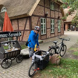
Abfahrt von Altenberg Teil 2
A cycling route starting in Altenberg, Saxony, Germany.
Overview
About this route
Route as a variant of suggestions from bikemap. Scenically very beautiful and due to long descents also suitable for less active riders. The Erzgebirge ridge offers, over large parts, beautiful views over Saxony and Bohemia. Along the way, on both sides of the border, there are good places for breaks and for dining. For mountain bikers, the hiking trail running approximately parallel to the ridge road is recommended. In the neighboring country, the route is largely recognizable by the cycling trail sign No. 23. 'Descent from Altenberg Part 1' starts in DD Großzschachwitz on Pirnaer Landstrasse near Bahnhofstrasse.
- -:--
- Duration
- 63.8 km
- Distance
- 445 m
- Ascent
- 1,084 m
- Descent
- ---
- Avg. speed
- 869 m
- Max. altitude
Route quality
Waytypes & surfaces along the route
Waytypes
Road
25.5 km
(40 %)
Cycleway
8.9 km
(14 %)
Surfaces
Paved
56.1 km
(88 %)
Unpaved
3.8 km
(6 %)
Asphalt
55.5 km
(87 %)
Ground
3.8 km
(6 %)
Route highlights
Points of interest along the route
Point of interest after 5.9 km
Mountainbikefahrer weiter auf der Straße zum höchsten Punkt auf dem Kamm. An der "Fußgängerbrücke" links rein und den Kammwanderweg lang.
Point of interest after 5.9 km
Startpunkt für Mountainbik auf den Kammwanderweg
Point of interest after 27.2 km
ab nun geht es ca. 25km Bergab
Point of interest after 31.7 km
Grenze zu Sachsen mit Olympiadenkmal
Point of interest after 51.5 km
nach der Abfahrt schmeckt in der Fußgängermeile bei "Alfredo" das Eisbesonders
Continue with Bikemap
Use, edit, or download this cycling route
You would like to ride Abfahrt von Altenberg Teil 2 or customize it for your own trip? Here is what you can do with this Bikemap route:
Free features
- Save this route as favorite or in collections
- Copy & plan your own version of this route
- Sync your route with Garmin or Wahoo
Premium features
Free trial for 3 days, or one-time payment. More about Bikemap Premium.
- Navigate this route on iOS & Android
- Export a GPX / KML file of this route
- Create your custom printout (try it for free)
- Download this route for offline navigation
Discover more Premium features.
Get Bikemap PremiumFrom our community
Other popular routes starting in Altenberg
 von Altenberg nach Dresden
- Distance
- 38.6 km
- Ascent
- 469 m
- Descent
- 1,040 m
- Location
- Altenberg, Saxony, Germany
 Erzgebirgs.Genuss.MTB-Tour 2012
- Distance
- 49.3 km
- Ascent
- 552 m
- Descent
- 552 m
- Location
- Altenberg, Saxony, Germany
 Osterzgebirge für Jan
- Distance
- 56.1 km
- Ascent
- 801 m
- Descent
- 800 m
- Location
- Altenberg, Saxony, Germany
 Botanischer Garten, Fun-Arena & Raupennest-Baude
- Distance
- 16 km
- Ascent
- 233 m
- Descent
- 233 m
- Location
- Altenberg, Saxony, Germany
 Tour 4 Von Altenberg nach Tharandt
- Distance
- 47.5 km
- Ascent
- 275 m
- Descent
- 814 m
- Location
- Altenberg, Saxony, Germany
 Hauptstraße nach Hauptstraße
- Distance
- 6.2 km
- Ascent
- 124 m
- Descent
- 120 m
- Location
- Altenberg, Saxony, Germany
 rodewisch (vogtl.)- coswig/ sa., 3. etappe, von moldava nach coswig
- Distance
- 103.1 km
- Ascent
- 209 m
- Descent
- 895 m
- Location
- Altenberg, Saxony, Germany
 Abfahrt von Altenberg Teil 2
- Distance
- 63.8 km
- Ascent
- 445 m
- Descent
- 1,084 m
- Location
- Altenberg, Saxony, Germany
Open it in the app


