

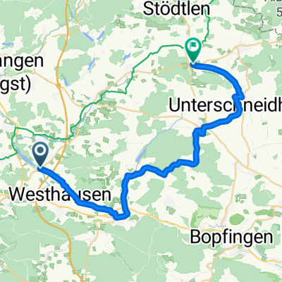
Tour Westhausen - Seebronn
A cycling route starting in Westhausen, Baden-Wurttemberg, Germany.
Overview
About this route
Bike tour from Ostalb to the edge of Gäu
- -:--
- Duration
- 146.2 km
- Distance
- 742 m
- Ascent
- 790 m
- Descent
- ---
- Avg. speed
- ---
- Max. altitude
Route quality
Waytypes & surfaces along the route
Waytypes
Track
54.1 km
(37 %)
Quiet road
40.9 km
(28 %)
Surfaces
Paved
108.2 km
(74 %)
Unpaved
23.4 km
(16 %)
Asphalt
97.9 km
(67 %)
Gravel
20.5 km
(14 %)
Continue with Bikemap
Use, edit, or download this cycling route
You would like to ride Tour Westhausen - Seebronn or customize it for your own trip? Here is what you can do with this Bikemap route:
Free features
- Save this route as favorite or in collections
- Copy & plan your own version of this route
- Split it into stages to create a multi-day tour
- Sync your route with Garmin or Wahoo
Premium features
Free trial for 3 days, or one-time payment. More about Bikemap Premium.
- Navigate this route on iOS & Android
- Export a GPX / KML file of this route
- Create your custom printout (try it for free)
- Download this route for offline navigation
Discover more Premium features.
Get Bikemap PremiumFrom our community
Other popular routes starting in Westhausen
 Radtour Dahlkingen - Gunzenhausen
- Distance
- 63.6 km
- Ascent
- 510 m
- Descent
- 549 m
- Location
- Westhausen, Baden-Wurttemberg, Germany
 Ellwanger Berge ...
- Distance
- 106.8 km
- Ascent
- 601 m
- Descent
- 600 m
- Location
- Westhausen, Baden-Wurttemberg, Germany
 JaKoQ13
- Distance
- 7.3 km
- Ascent
- 36 m
- Descent
- 104 m
- Location
- Westhausen, Baden-Wurttemberg, Germany
 Westhausen, Annaberg, Ebnat, Lauchheim
- Distance
- 39.9 km
- Ascent
- 658 m
- Descent
- 543 m
- Location
- Westhausen, Baden-Wurttemberg, Germany
 Westhausen Seebronn V3
- Distance
- 130.9 km
- Ascent
- 452 m
- Descent
- 505 m
- Location
- Westhausen, Baden-Wurttemberg, Germany
 Von Bucher Stausee nach Riepach
- Distance
- 28.8 km
- Ascent
- 206 m
- Descent
- 147 m
- Location
- Westhausen, Baden-Wurttemberg, Germany
 Turm Runde
- Distance
- 34 km
- Ascent
- 444 m
- Descent
- 443 m
- Location
- Westhausen, Baden-Wurttemberg, Germany
 aalen simmisweiler-großkuchen-mimmisweiler
- Distance
- 29.7 km
- Ascent
- 208 m
- Descent
- 211 m
- Location
- Westhausen, Baden-Wurttemberg, Germany
Open it in the app