

Halbe Route
A cycling route starting in Kollbrunn / Kollbrunn (Dorfkern), Canton of Zurich, Switzerland.
Overview
About this route
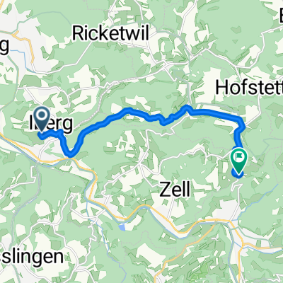
Via Weisslingerbrücke zu Rengglis und am anderen Ufer uzurück zur Weisslingerbrücke, dann zur Aubrücke und via Kirchstrasse zurück.
- -:--
- Duration
- 2.4 km
- Distance
- 10 m
- Ascent
- 10 m
- Descent
- ---
- Avg. speed
- ---
- Max. altitude
Continue with Bikemap
Use, edit, or download this cycling route
You would like to ride Halbe Route or customize it for your own trip? Here is what you can do with this Bikemap route:
Free features
- Save this route as favorite or in collections
- Copy & plan your own version of this route
- Sync your route with Garmin or Wahoo
Premium features
Free trial for 3 days, or one-time payment. More about Bikemap Premium.
- Navigate this route on iOS & Android
- Export a GPX / KML file of this route
- Create your custom printout (try it for free)
- Download this route for offline navigation
Discover more Premium features.
Get Bikemap PremiumFrom our community
Other popular routes starting in Kollbrunn / Kollbrunn (Dorfkern)
 Seemerrütiweg, Kollbrunn nach Tösstalstrasse 23, Kollbrunn
- Distance
- 55 km
- Ascent
- 2,903 m
- Descent
- 2,904 m
- Location
- Kollbrunn / Kollbrunn (Dorfkern), Canton of Zurich, Switzerland
 samstigstürli 23.05.20
- Distance
- 53.9 km
- Ascent
- 450 m
- Descent
- 450 m
- Location
- Kollbrunn / Kollbrunn (Dorfkern), Canton of Zurich, Switzerland
 Tösstalstrasse 22A, Kollbrunn nach Tösstalstrasse 22A, Kollbrunn
- Distance
- 38.2 km
- Ascent
- 2,834 m
- Descent
- 1,843 m
- Location
- Kollbrunn / Kollbrunn (Dorfkern), Canton of Zurich, Switzerland
 Tösstalstrasse, Kollbrunn nach Riedmühlestrasse 1, Sulz
- Distance
- 14 km
- Ascent
- 120 m
- Descent
- 166 m
- Location
- Kollbrunn / Kollbrunn (Dorfkern), Canton of Zurich, Switzerland
 Feierabendrunde
- Distance
- 22 km
- Ascent
- 561 m
- Descent
- 566 m
- Location
- Kollbrunn / Kollbrunn (Dorfkern), Canton of Zurich, Switzerland
 Halbe Route
- Distance
- 2.4 km
- Ascent
- 10 m
- Descent
- 10 m
- Location
- Kollbrunn / Kollbrunn (Dorfkern), Canton of Zurich, Switzerland
 Gyrenbad Gasthof
- Distance
- 9.1 km
- Ascent
- 383 m
- Descent
- 217 m
- Location
- Kollbrunn / Kollbrunn (Dorfkern), Canton of Zurich, Switzerland
 Tösstal
- Distance
- 26.3 km
- Ascent
- 510 m
- Descent
- 1,003 m
- Location
- Kollbrunn / Kollbrunn (Dorfkern), Canton of Zurich, Switzerland
Open it in the app