

Rottweil-Schwenningen
A cycling route starting in Dauchingen, Baden-Wurttemberg, Germany.
Overview
About this route
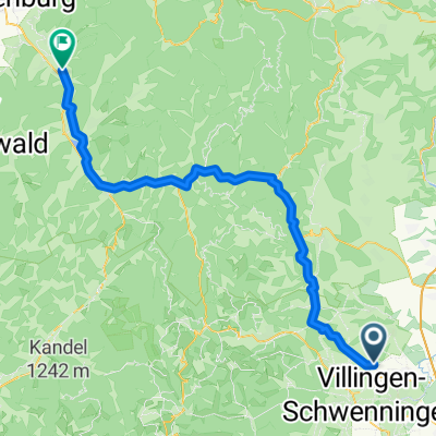
Rottweil-Horgen-Niedereschach-Kappel-Weilersbach-Schwenningen-Deisslingen-Lweil-auffen ob Rottweil-Bühlingen-Rottweil
- -:--
- Duration
- 45.6 km
- Distance
- 359 m
- Ascent
- 359 m
- Descent
- ---
- Avg. speed
- ---
- Max. altitude
Route quality
Waytypes & surfaces along the route
Waytypes
Quiet road
13 km
(29 %)
Track
9.7 km
(21 %)
Surfaces
Paved
38.4 km
(84 %)
Unpaved
3.5 km
(8 %)
Asphalt
36 km
(79 %)
Gravel
2.7 km
(6 %)
Continue with Bikemap
Use, edit, or download this cycling route
You would like to ride Rottweil-Schwenningen or customize it for your own trip? Here is what you can do with this Bikemap route:
Free features
- Save this route as favorite or in collections
- Copy & plan your own version of this route
- Sync your route with Garmin or Wahoo
Premium features
Free trial for 3 days, or one-time payment. More about Bikemap Premium.
- Navigate this route on iOS & Android
- Export a GPX / KML file of this route
- Create your custom printout (try it for free)
- Download this route for offline navigation
Discover more Premium features.
Get Bikemap PremiumFrom our community
Other popular routes starting in Dauchingen
 Villingen_Rund um Villingen
- Distance
- 42.6 km
- Ascent
- 328 m
- Descent
- 327 m
- Location
- Dauchingen, Baden-Wurttemberg, Germany
 Weilersbach über Königsfeld Hardt 812m nach Gengenbach auf Kinzigdamm
- Distance
- 74.2 km
- Ascent
- 1,296 m
- Descent
- 1,842 m
- Location
- Dauchingen, Baden-Wurttemberg, Germany
 Weilersbach über Burgberg nach Gengenbach
- Distance
- 73.8 km
- Ascent
- 1,178 m
- Descent
- 1,729 m
- Location
- Dauchingen, Baden-Wurttemberg, Germany
 Weilersbach, Schwenningen, Deißlingen
- Distance
- 28.8 km
- Ascent
- 353 m
- Descent
- 353 m
- Location
- Dauchingen, Baden-Wurttemberg, Germany
 Oberhohenberg - Schörzinger Hütte
- Distance
- 54.2 km
- Ascent
- 633 m
- Descent
- 641 m
- Location
- Dauchingen, Baden-Wurttemberg, Germany
 Corona Homerun
- Distance
- 61.6 km
- Ascent
- 559 m
- Descent
- 562 m
- Location
- Dauchingen, Baden-Wurttemberg, Germany
 Weilersbach über Tischneck nach Schramberg Schiltach Hausach
- Distance
- 48.4 km
- Ascent
- 1,297 m
- Descent
- 1,766 m
- Location
- Dauchingen, Baden-Wurttemberg, Germany
 Schwenninger Kurs
- Distance
- 6.4 km
- Ascent
- 69 m
- Descent
- 68 m
- Location
- Dauchingen, Baden-Wurttemberg, Germany
Open it in the app