

Bike ride 08/01/2015
A cycling route starting in West Pleasant View, Colorado, United States.
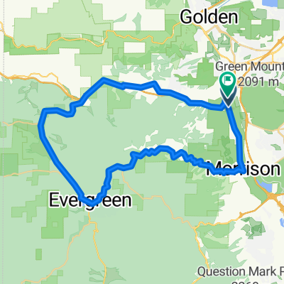
Overview
About this route
Lakewood, Littleton, Highgrade, Dear Creek, Evergreen, Lakewood
- -:--
- Duration
- 112.5 km
- Distance
- 1,540 m
- Ascent
- 1,540 m
- Descent
- ---
- Avg. speed
- ---
- Max. altitude
Route quality
Waytypes & surfaces along the route
Waytypes
Road
51.7 km
(46 %)
Busy road
29.3 km
(26 %)
Surfaces
Paved
60.1 km
(53 %)
Unpaved
2.8 km
(2 %)
Asphalt
45.3 km
(40 %)
Concrete
12.5 km
(11 %)
Continue with Bikemap
Use, edit, or download this cycling route
You would like to ride Bike ride 08/01/2015 or customize it for your own trip? Here is what you can do with this Bikemap route:
Free features
- Save this route as favorite or in collections
- Copy & plan your own version of this route
- Split it into stages to create a multi-day tour
- Sync your route with Garmin or Wahoo
Premium features
Free trial for 3 days, or one-time payment. More about Bikemap Premium.
- Navigate this route on iOS & Android
- Export a GPX / KML file of this route
- Create your custom printout (try it for free)
- Download this route for offline navigation
Discover more Premium features.
Get Bikemap PremiumFrom our community
Other popular routes starting in West Pleasant View
 Denver Loop
- Distance
- 68.5 km
- Ascent
- 387 m
- Descent
- 380 m
- Location
- West Pleasant View, Colorado, United States
 test climb
- Distance
- 54.1 km
- Ascent
- 893 m
- Descent
- 893 m
- Location
- West Pleasant View, Colorado, United States
 GM Short Ride #1
- Distance
- 12.6 km
- Ascent
- 533 m
- Descent
- 536 m
- Location
- West Pleasant View, Colorado, United States
 dino to Bergen Park
- Distance
- 27.8 km
- Ascent
- 782 m
- Descent
- 350 m
- Location
- West Pleasant View, Colorado, United States
 Golden Short #2
- Distance
- 47.4 km
- Ascent
- 746 m
- Descent
- 748 m
- Location
- West Pleasant View, Colorado, United States
 South Table Mesa
- Distance
- 11 km
- Ascent
- 212 m
- Descent
- 226 m
- Location
- West Pleasant View, Colorado, United States
 funk dat
- Distance
- 6.2 km
- Ascent
- 249 m
- Descent
- 358 m
- Location
- West Pleasant View, Colorado, United States
 Forgotten Ending
- Distance
- 6 km
- Ascent
- 174 m
- Descent
- 270 m
- Location
- West Pleasant View, Colorado, United States
Open it in the app