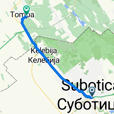
Palić - Bačka Palanka
A cycling route starting in Subotica, Vojvodina, Serbia.
Overview
About this route
02.08.2015
Palić - Subotica - Stari Žednik - Mali Beograd - Bačka Topola - Bajša - Lipar - Kula - Savino Selo - Despotovo - Silbaš - Gajdobra - Nova Gajdobra - Bačka Palanka- -:--
- Duration
- 115.2 km
- Distance
- 46 m
- Ascent
- 70 m
- Descent
- ---
- Avg. speed
- ---
- Avg. speed
Route quality
Waytypes & surfaces along the route
Waytypes
Busy road
76.4 km
(66 %)
Cycleway
24.1 km
(21 %)
Surfaces
Paved
78.1 km
(68 %)
Asphalt
75.6 km
(66 %)
Concrete
2.2 km
(2 %)
Continue with Bikemap
Use, edit, or download this cycling route
You would like to ride Palić - Bačka Palanka or customize it for your own trip? Here is what you can do with this Bikemap route:
Free features
- Save this route as favorite or in collections
- Copy & plan your own version of this route
- Split it into stages to create a multi-day tour
- Sync your route with Garmin or Wahoo
Premium features
Free trial for 3 days, or one-time payment. More about Bikemap Premium.
- Navigate this route on iOS & Android
- Export a GPX / KML file of this route
- Create your custom printout (try it for free)
- Download this route for offline navigation
Discover more Premium features.
Get Bikemap PremiumFrom our community
Other popular routes starting in Subotica
- duga ruta :D
- Distance
- 83 km
- Ascent
- 75 m
- Descent
- 73 m
- Location
- Subotica, Vojvodina, Serbia
- Szabadka(Villa S-Rooms G)2,5km
- Distance
- 2.2 km
- Ascent
- 0 m
- Descent
- 8 m
- Location
- Subotica, Vojvodina, Serbia
- Palić - Bačka Palanka
- Distance
- 115.2 km
- Ascent
- 46 m
- Descent
- 70 m
- Location
- Subotica, Vojvodina, Serbia
- Pazinska 3, Subotica to Pazinska 5, Subotica
- Distance
- 37 km
- Ascent
- 40 m
- Descent
- 41 m
- Location
- Subotica, Vojvodina, Serbia
- suba bejbi
- Distance
- 42.7 km
- Ascent
- 33 m
- Descent
- 41 m
- Location
- Subotica, Vojvodina, Serbia
- Szabadka-Magyarkanizsa 40km OSM
- Distance
- 39.8 km
- Ascent
- 17 m
- Descent
- 41 m
- Location
- Subotica, Vojvodina, Serbia
- Pityutour
- Distance
- 32.7 km
- Ascent
- 28 m
- Descent
- 24 m
- Location
- Subotica, Vojvodina, Serbia
- Szabadka-Magyarkanizsa ver1 52km OSM
- Distance
- 51.5 km
- Ascent
- 27 m
- Descent
- 54 m
- Location
- Subotica, Vojvodina, Serbia
Open it in the app