

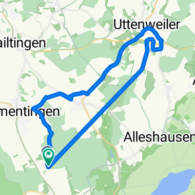
Rund um den Federsee
A cycling route starting in Kanzach, Baden-Wurttemberg, Germany.
Overview
About this route
Eine einfache Strecke auch für Kinder geeignet, Anfangs über Landstraßen. Keine Steigungen
(cloned from route 1013728)- -:--
- Duration
- 24 km
- Distance
- 110 m
- Ascent
- 109 m
- Descent
- ---
- Avg. speed
- ---
- Max. altitude
Route quality
Waytypes & surfaces along the route
Waytypes
Road
9.3 km
(39 %)
Busy road
3.6 km
(15 %)
Surfaces
Paved
6.5 km
(27 %)
Unpaved
3.9 km
(16 %)
Asphalt
6.1 km
(26 %)
Loose gravel
1.9 km
(8 %)
Continue with Bikemap
Use, edit, or download this cycling route
You would like to ride Rund um den Federsee or customize it for your own trip? Here is what you can do with this Bikemap route:
Free features
- Save this route as favorite or in collections
- Copy & plan your own version of this route
- Sync your route with Garmin or Wahoo
Premium features
Free trial for 3 days, or one-time payment. More about Bikemap Premium.
- Navigate this route on iOS & Android
- Export a GPX / KML file of this route
- Create your custom printout (try it for free)
- Download this route for offline navigation
Discover more Premium features.
Get Bikemap PremiumFrom our community
Other popular routes starting in Kanzach
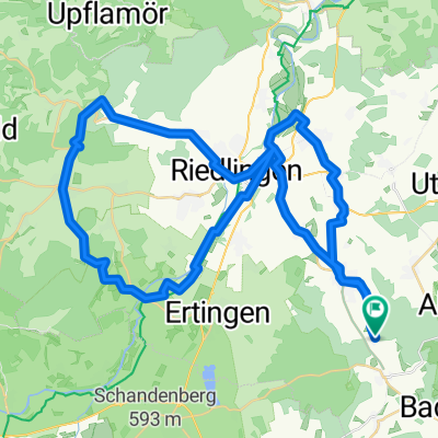
 Seelenwald - Schienenhof - Oggelshausen - Kanzach
- Distance
- 31.1 km
- Ascent
- 20 m
- Descent
- 23 m
- Location
- Kanzach, Baden-Wurttemberg, Germany
 Kanzach nach Kanzach
- Distance
- 0.2 km
- Ascent
- 4 m
- Descent
- 13 m
- Location
- Kanzach, Baden-Wurttemberg, Germany
 L282, Ertingen nach Plettenbergstraße 7, Geislingen
- Distance
- 170.1 km
- Ascent
- 1,292 m
- Descent
- 1,359 m
- Location
- Kanzach, Baden-Wurttemberg, Germany
 Seelenwald nach Seelenwald
- Distance
- 20.6 km
- Ascent
- 94 m
- Descent
- 145 m
- Location
- Kanzach, Baden-Wurttemberg, Germany
 Rund um den Federsee
- Distance
- 24 km
- Ascent
- 132 m
- Descent
- 130 m
- Location
- Kanzach, Baden-Wurttemberg, Germany
 Marbacher Straße 1, Kanzach nach Schillerstraße 8, Ertingen
- Distance
- 7.8 km
- Ascent
- 0 m
- Descent
- 5 m
- Location
- Kanzach, Baden-Wurttemberg, Germany
 Seelenwald-Pflummern- HKt-Unlingen-Seelenwald
- Distance
- 57 km
- Ascent
- 471 m
- Descent
- 505 m
- Location
- Kanzach, Baden-Wurttemberg, Germany
 bad buchau
- Distance
- 4.4 km
- Ascent
- 64 m
- Descent
- 63 m
- Location
- Kanzach, Baden-Wurttemberg, Germany
Open it in the app