

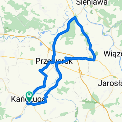
115 (65/15) Łańcut - Leżajsk - Ożanna - Sieniawa - Przeworsk
A cycling route starting in Kańczuga, Subcarpathian Voivodeship, Poland.
Overview
About this route
Ok 2 km bezasfalcia nad zalewem w Ożannie ( płytki chodnikowe i piasek)
- -:--
- Duration
- 115.4 km
- Distance
- 259 m
- Ascent
- 262 m
- Descent
- ---
- Avg. speed
- ---
- Max. altitude

Route quality
Waytypes & surfaces along the route
Waytypes
Busy road
62.3 km
(54 %)
Road
24.3 km
(21 %)
Surfaces
Paved
94.6 km
(82 %)
Unpaved
0.9 km
(<1 %)
Asphalt
92.5 km
(80 %)
Paving stones
1.6 km
(1 %)
Continue with Bikemap
Use, edit, or download this cycling route
You would like to ride 115 (65/15) Łańcut - Leżajsk - Ożanna - Sieniawa - Przeworsk or customize it for your own trip? Here is what you can do with this Bikemap route:
Free features
- Save this route as favorite or in collections
- Copy & plan your own version of this route
- Split it into stages to create a multi-day tour
- Sync your route with Garmin or Wahoo
Premium features
Free trial for 3 days, or one-time payment. More about Bikemap Premium.
- Navigate this route on iOS & Android
- Export a GPX / KML file of this route
- Create your custom printout (try it for free)
- Download this route for offline navigation
Discover more Premium features.
Get Bikemap PremiumFrom our community
Other popular routes starting in Kańczuga
 # 3 GSR "EDU 9"
- Distance
- 43.2 km
- Ascent
- 380 m
- Descent
- 388 m
- Location
- Kańczuga, Subcarpathian Voivodeship, Poland
 113/SIENIAWA-KURYŁÓWKA-ŁAŃCUT
- Distance
- 113.4 km
- Ascent
- 261 m
- Descent
- 261 m
- Location
- Kańczuga, Subcarpathian Voivodeship, Poland
 130 (55/16) Rudołowice-Radymno-Wiązownica-Radawa-Sieniawa-Przeworsk
- Distance
- 133.9 km
- Ascent
- 258 m
- Descent
- 260 m
- Location
- Kańczuga, Subcarpathian Voivodeship, Poland
 65 (64/16) Przeworsk-Tryńcza-Pełkinie-Krzeczowice
- Distance
- 64.6 km
- Ascent
- 134 m
- Descent
- 134 m
- Location
- Kańczuga, Subcarpathian Voivodeship, Poland
 #2 GSR "Junior"
- Distance
- 17.3 km
- Ascent
- 145 m
- Descent
- 137 m
- Location
- Kańczuga, Subcarpathian Voivodeship, Poland
 Siedleczka Wzniesienie
- Distance
- 19.5 km
- Ascent
- 303 m
- Descent
- 303 m
- Location
- Kańczuga, Subcarpathian Voivodeship, Poland
 Kańczuga Łopuszka Manasterz SIetesz. Podparpackie pogórze
- Distance
- 38.8 km
- Ascent
- 470 m
- Descent
- 470 m
- Location
- Kańczuga, Subcarpathian Voivodeship, Poland
 75 (19/16) Rożniatów-Jarosław-WÓLKA PEŁKIŃSKA-Tryńcza-Przeworsk
- Distance
- 74.2 km
- Ascent
- 271 m
- Descent
- 271 m
- Location
- Kańczuga, Subcarpathian Voivodeship, Poland
Open it in the app