

Recording from 2 August 14:41
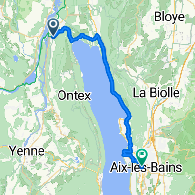
A cycling route starting in Châtillon, Auvergne-Rhône-Alpes, France.
Overview
About this route
- 5 h 51 min
- Duration
- 41 km
- Distance
- 558 m
- Ascent
- 579 m
- Descent
- 7 km/h
- Avg. speed
- ---
- Max. altitude
Route quality
Waytypes & surfaces along the route
Waytypes
Path
4.9 km
(12 %)
Quiet road
2.9 km
(7 %)
Surfaces
Paved
20.9 km
(51 %)
Asphalt
20.5 km
(50 %)
Concrete
0.4 km
(1 %)
Undefined
20.1 km
(49 %)
Continue with Bikemap
Use, edit, or download this cycling route
You would like to ride Recording from 2 August 14:41 or customize it for your own trip? Here is what you can do with this Bikemap route:
Free features
- Save this route as favorite or in collections
- Copy & plan your own version of this route
- Sync your route with Garmin or Wahoo
Premium features
Free trial for 3 days, or one-time payment. More about Bikemap Premium.
- Navigate this route on iOS & Android
- Export a GPX / KML file of this route
- Create your custom printout (try it for free)
- Download this route for offline navigation
Discover more Premium features.
Get Bikemap PremiumFrom our community
Other popular routes starting in Châtillon
 Tag 4 Mont Ventoux
- Distance
- 103 km
- Ascent
- 586 m
- Descent
- 541 m
- Location
- Châtillon, Auvergne-Rhône-Alpes, France
 chanazJongieuChanaz
- Distance
- 37.5 km
- Ascent
- 1,135 m
- Descent
- 1,143 m
- Location
- Châtillon, Auvergne-Rhône-Alpes, France
 Alpen 2015 - Dag 5
- Distance
- 95.9 km
- Ascent
- 2,079 m
- Descent
- 1,865 m
- Location
- Châtillon, Auvergne-Rhône-Alpes, France
 Etape 3 (58km) - Camping de Chanaz à celui de Morestel
- Distance
- 58.4 km
- Ascent
- 263 m
- Descent
- 284 m
- Location
- Châtillon, Auvergne-Rhône-Alpes, France
 De Conjux à Vions - Chanaz
- Distance
- 13 km
- Ascent
- 51 m
- Descent
- 45 m
- Location
- Châtillon, Auvergne-Rhône-Alpes, France
 67km2100hmSaintPierreDeCurtille
- Distance
- 67.3 km
- Ascent
- 0 m
- Descent
- 0 m
- Location
- Châtillon, Auvergne-Rhône-Alpes, France
 Chanaz Ontex
- Distance
- 35.5 km
- Ascent
- 1,192 m
- Descent
- 1,176 m
- Location
- Châtillon, Auvergne-Rhône-Alpes, France
 Chanaz - Aix-les-Bains - 1-Chanaz - Aix-les-Bains
- Distance
- 24.5 km
- Ascent
- 390 m
- Descent
- 383 m
- Location
- Châtillon, Auvergne-Rhône-Alpes, France
Open it in the app