

Le canal du Nivernais /été 2014
A cycling route starting in Prémery, Bourgogne-Franche-Comté, France.
Overview
About this route
- -:--
- Duration
- 379.3 km
- Distance
- 392 m
- Ascent
- 518 m
- Descent
- ---
- Avg. speed
- ---
- Max. altitude

Route quality
Waytypes & surfaces along the route
Waytypes
Cycleway
142.6 km
(38 %)
Road
74.9 km
(20 %)
Surfaces
Paved
229.7 km
(61 %)
Unpaved
26.1 km
(7 %)
Asphalt
217.7 km
(57 %)
Ground
25.8 km
(7 %)
Route highlights
Points of interest along the route
Point of interest after 33.3 km
camping Nevers
Point of interest after 66.8 km
camping des Halles - Decize
Point of interest after 76.6 km
visite de la mine de la Machine
Point of interest after 96.8 km
camping municipal de Cercy
Point of interest after 151 km
camping de Baye
Point of interest after 187.2 km
Camping des Fontaines
Point of interest after 257.5 km
camping des Prés
Point of interest after 299.4 km
camping du Pont Picot - Clamecy
Point of interest after 328.6 km
camping du Pré du Roy
Point of interest after 357.7 km
Maison des Randonneurs - Auxerre
Continue with Bikemap
Use, edit, or download this cycling route
You would like to ride Le canal du Nivernais /été 2014 or customize it for your own trip? Here is what you can do with this Bikemap route:
Free features
- Save this route as favorite or in collections
- Copy & plan your own version of this route
- Split it into stages to create a multi-day tour
- Sync your route with Garmin or Wahoo
Premium features
Free trial for 3 days, or one-time payment. More about Bikemap Premium.
- Navigate this route on iOS & Android
- Export a GPX / KML file of this route
- Create your custom printout (try it for free)
- Download this route for offline navigation
Discover more Premium features.
Get Bikemap PremiumFrom our community
Other popular routes starting in Prémery
 Le canal du Nivernais /été 2014
- Distance
- 379.3 km
- Ascent
- 392 m
- Descent
- 518 m
- Location
- Prémery, Bourgogne-Franche-Comté, France
 Day 8 - Crux-la Ville - Gien -back to EV6
- Distance
- 118 km
- Ascent
- 242 m
- Descent
- 450 m
- Location
- Prémery, Bourgogne-Franche-Comté, France
 11 Saint-Francy nach Nevers
- Distance
- 36.4 km
- Ascent
- 385 m
- Descent
- 460 m
- Location
- Prémery, Bourgogne-Franche-Comté, France
 Short route starting/ending in Chapallement (Morvan, France)
- Distance
- 27.4 km
- Ascent
- 338 m
- Descent
- 336 m
- Location
- Prémery, Bourgogne-Franche-Comté, France
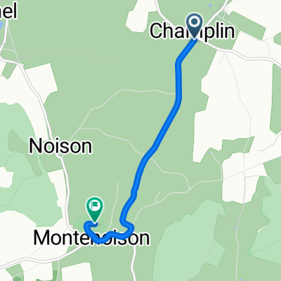 BUTTE DE MONTENOISON, por Champlin
- Distance
- 3.9 km
- Ascent
- 186 m
- Descent
- 24 m
- Location
- Prémery, Bourgogne-Franche-Comté, France
 De Les Ombreaux 59, Arzembouy à Les Ombreaux 59, Arzembouy
- Distance
- 19.4 km
- Ascent
- 196 m
- Descent
- 197 m
- Location
- Prémery, Bourgogne-Franche-Comté, France
 rondje etang du merle
- Distance
- 34.6 km
- Ascent
- 513 m
- Descent
- 542 m
- Location
- Prémery, Bourgogne-Franche-Comté, France
 De Les Ombreaux 59, Arzembouy à Les Ombreaux 59, Arzembouy
- Distance
- 24.5 km
- Ascent
- 270 m
- Descent
- 275 m
- Location
- Prémery, Bourgogne-Franche-Comté, France
Open it in the app