

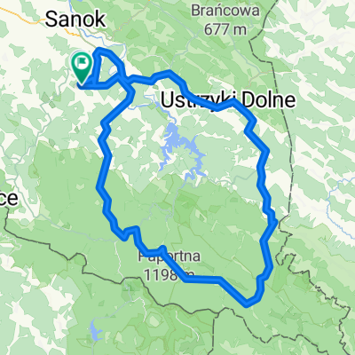
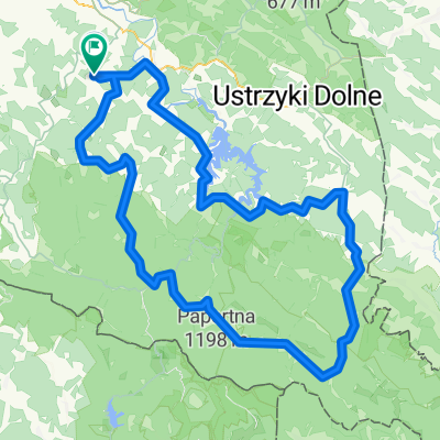
Tarnawa Grn - Jeziorko Bobrowe - Wierchy
A cycling route starting in Czaszyn, Subcarpathian Voivodeship, Poland.
Overview
About this route
Tarnawa - Średnie Wlk - Choceń - Lisowiec - Cisowiec - Kielczawa - Jeziorko Bobrowe - Baligród - Markowska - Wierchy - Hoczew - Tarnawa
- -:--
- Duration
- 80.9 km
- Distance
- 1,226 m
- Ascent
- 1,225 m
- Descent
- ---
- Avg. speed
- ---
- Max. altitude
Route quality
Waytypes & surfaces along the route
Waytypes
Track
35.6 km
(44 %)
Road
20.6 km
(25 %)
Surfaces
Paved
43 km
(53 %)
Unpaved
13.4 km
(17 %)
Asphalt
26.5 km
(33 %)
Paved (undefined)
16.2 km
(20 %)
Continue with Bikemap
Use, edit, or download this cycling route
You would like to ride Tarnawa Grn - Jeziorko Bobrowe - Wierchy or customize it for your own trip? Here is what you can do with this Bikemap route:
Free features
- Save this route as favorite or in collections
- Copy & plan your own version of this route
- Split it into stages to create a multi-day tour
- Sync your route with Garmin or Wahoo
Premium features
Free trial for 3 days, or one-time payment. More about Bikemap Premium.
- Navigate this route on iOS & Android
- Export a GPX / KML file of this route
- Create your custom printout (try it for free)
- Download this route for offline navigation
Discover more Premium features.
Get Bikemap PremiumFrom our community
Other popular routes starting in Czaszyn
 Wielka Obwodnica Bieszczadzka
- Distance
- 178.1 km
- Ascent
- 2,730 m
- Descent
- 2,736 m
- Location
- Czaszyn, Subcarpathian Voivodeship, Poland
 Bieszczady Sakwy 2020 day1
- Distance
- 43.2 km
- Ascent
- 818 m
- Descent
- 565 m
- Location
- Czaszyn, Subcarpathian Voivodeship, Poland
 Bieszczad III
- Distance
- 115.5 km
- Ascent
- 958 m
- Descent
- 957 m
- Location
- Czaszyn, Subcarpathian Voivodeship, Poland
 2021 d3.
- Distance
- 32.6 km
- Ascent
- 441 m
- Descent
- 443 m
- Location
- Czaszyn, Subcarpathian Voivodeship, Poland
 Tarnawa Grn - Jeziorko Bobrowe - Wierchy
- Distance
- 80.9 km
- Ascent
- 1,226 m
- Descent
- 1,225 m
- Location
- Czaszyn, Subcarpathian Voivodeship, Poland
 Bieszczady 2015
- Distance
- 155.7 km
- Ascent
- 1,501 m
- Descent
- 1,503 m
- Location
- Czaszyn, Subcarpathian Voivodeship, Poland
 Bieszczady
- Distance
- 171.9 km
- Ascent
- 3,337 m
- Descent
- 3,353 m
- Location
- Czaszyn, Subcarpathian Voivodeship, Poland
 czaszyn
- Distance
- 97.2 km
- Ascent
- 1,449 m
- Descent
- 1,431 m
- Location
- Czaszyn, Subcarpathian Voivodeship, Poland
Open it in the app