

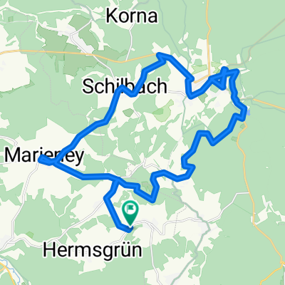
1.Tag unserer Kammtour
A cycling route starting in Schöneck, Saxony, Germany.
Overview
About this route
1st part of our ridge tour from Vogtland to Erzgebirge with ascent to Keilberg (1,244 m)
- -:--
- Duration
- 102.6 km
- Distance
- 1,227 m
- Ascent
- 1,107 m
- Descent
- ---
- Avg. speed
- ---
- Max. altitude
Route quality
Waytypes & surfaces along the route
Waytypes
Track
44.1 km
(43 %)
Road
18.5 km
(18 %)
Surfaces
Paved
53.3 km
(52 %)
Unpaved
32.8 km
(32 %)
Asphalt
48.2 km
(47 %)
Gravel
19.5 km
(19 %)
Continue with Bikemap
Use, edit, or download this cycling route
You would like to ride 1.Tag unserer Kammtour or customize it for your own trip? Here is what you can do with this Bikemap route:
Free features
- Save this route as favorite or in collections
- Copy & plan your own version of this route
- Split it into stages to create a multi-day tour
- Sync your route with Garmin or Wahoo
Premium features
Free trial for 3 days, or one-time payment. More about Bikemap Premium.
- Navigate this route on iOS & Android
- Export a GPX / KML file of this route
- Create your custom printout (try it for free)
- Download this route for offline navigation
Discover more Premium features.
Get Bikemap PremiumFrom our community
Other popular routes starting in Schöneck
 Wohlbach-Schöneck-Erlbach-Wohlbach
- Distance
- 41.7 km
- Ascent
- 717 m
- Descent
- 764 m
- Location
- Schöneck, Saxony, Germany
 best off Vogtland >>> Schilbach - Schönecl
- Distance
- 5.3 km
- Ascent
- 241 m
- Descent
- 8 m
- Location
- Schöneck, Saxony, Germany
 Wohlbach - Schöneck - Marieney
- Distance
- 28.6 km
- Ascent
- 515 m
- Descent
- 515 m
- Location
- Schöneck, Saxony, Germany
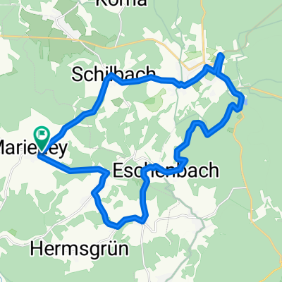 Rund um Schöneck - Eschenbach
- Distance
- 21.4 km
- Ascent
- 485 m
- Descent
- 485 m
- Location
- Schöneck, Saxony, Germany
 Wohlbach-Vogtlandarena-Klingenthal-Schöneck
- Distance
- 42 km
- Ascent
- 669 m
- Descent
- 669 m
- Location
- Schöneck, Saxony, Germany
 Wohlbach - Adorf - Siebenbrunn - Gunzen - Wohlbach
- Distance
- 21.8 km
- Ascent
- 264 m
- Descent
- 217 m
- Location
- Schöneck, Saxony, Germany
 Wohlbach-Adorf-Sohl-Markneukirchen(Berg)-Breitenfeld
- Distance
- 33 km
- Ascent
- 470 m
- Descent
- 470 m
- Location
- Schöneck, Saxony, Germany
 Wohlbach - Erlbach - Markneukirchen - Adorf - Saalig
- Distance
- 37.4 km
- Ascent
- 468 m
- Descent
- 468 m
- Location
- Schöneck, Saxony, Germany
Open it in the app