

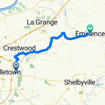
OKHT 2014
A cycling route starting in Anchorage, Kentucky, United States.
Overview
About this route
OKHT route 2014 (?)
(cloned from route 3189808)
- -:--
- Duration
- 80.1 km
- Distance
- 362 m
- Ascent
- 377 m
- Descent
- ---
- Avg. speed
- ---
- Max. altitude
Route quality
Waytypes & surfaces along the route
Waytypes
Quiet road
20.8 km
(26 %)
Road
16.8 km
(21 %)
Surfaces
Paved
12 km
(15 %)
Asphalt
11.2 km
(14 %)
Paved (undefined)
0.8 km
(1 %)
Undefined
68.1 km
(85 %)
Continue with Bikemap
Use, edit, or download this cycling route
You would like to ride OKHT 2014 or customize it for your own trip? Here is what you can do with this Bikemap route:
Free features
- Save this route as favorite or in collections
- Copy & plan your own version of this route
- Split it into stages to create a multi-day tour
- Sync your route with Garmin or Wahoo
Premium features
Free trial for 3 days, or one-time payment. More about Bikemap Premium.
- Navigate this route on iOS & Android
- Export a GPX / KML file of this route
- Create your custom printout (try it for free)
- Download this route for offline navigation
Discover more Premium features.
Get Bikemap PremiumFrom our community
Other popular routes starting in Anchorage
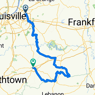
 Emmenece Ride
- Distance
- 42.3 km
- Ascent
- 311 m
- Descent
- 238 m
- Location
- Anchorage, Kentucky, United States
 OKyHT-104
- Distance
- 165.3 km
- Ascent
- 1,098 m
- Descent
- 1,126 m
- Location
- Anchorage, Kentucky, United States
 Sleepy Hollow
- Distance
- 39.2 km
- Ascent
- 161 m
- Descent
- 135 m
- Location
- Anchorage, Kentucky, United States
 OKHT 2014
- Distance
- 80.1 km
- Ascent
- 362 m
- Descent
- 377 m
- Location
- Anchorage, Kentucky, United States
 1808 Telluride Way, Louisville to Lewis and Clark Bridge, Louisville
- Distance
- 14.1 km
- Ascent
- 89 m
- Descent
- 167 m
- Location
- Anchorage, Kentucky, United States
 12104 Log Cabin Ln, Anchorage to 12002 Old Henry Rd, Middletown
- Distance
- 19.9 km
- Ascent
- 161 m
- Descent
- 159 m
- Location
- Anchorage, Kentucky, United States
 3000 Freys Hill Rd, Louisville to 7815 Fairmeadows Ln, Graymoor-Devondale
- Distance
- 9.7 km
- Ascent
- 27 m
- Descent
- 56 m
- Location
- Anchorage, Kentucky, United States
 3000 Freys Hill Rd, Louisville to 7815 Fairmeadows Ln, Graymoor-Devondale
- Distance
- 7.7 km
- Ascent
- 37 m
- Descent
- 54 m
- Location
- Anchorage, Kentucky, United States
Open it in the app