

Regental-Radweg, Tag 2: Kaikenried---Regen---Wetterfeld CLONED FROM ROUTE 318499
A cycling route starting in Patersdorf, Bavaria, Germany.
Overview
About this route
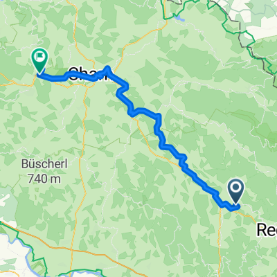
a bit up and down to Vietach, then on the old railway line, a spectacularly beautiful cycling path section, continuing along the river. before and after Cham rather boring, a wide river valley
- -:--
- Duration
- 67.9 km
- Distance
- 307 m
- Ascent
- 447 m
- Descent
- ---
- Avg. speed
- ---
- Max. altitude
Continue with Bikemap
Use, edit, or download this cycling route
You would like to ride Regental-Radweg, Tag 2: Kaikenried---Regen---Wetterfeld CLONED FROM ROUTE 318499 or customize it for your own trip? Here is what you can do with this Bikemap route:
Free features
- Save this route as favorite or in collections
- Copy & plan your own version of this route
- Sync your route with Garmin or Wahoo
Premium features
Free trial for 3 days, or one-time payment. More about Bikemap Premium.
- Navigate this route on iOS & Android
- Export a GPX / KML file of this route
- Create your custom printout (try it for free)
- Download this route for offline navigation
Discover more Premium features.
Get Bikemap PremiumFrom our community
Other popular routes starting in Patersdorf
 2009 Kaikenried---Regen---Wetterfeld
- Distance
- 65.5 km
- Ascent
- 372 m
- Descent
- 512 m
- Location
- Patersdorf, Bavaria, Germany
 Knabenhof - Kollnburg - Knabenhof
- Distance
- 25.8 km
- Ascent
- 687 m
- Descent
- 690 m
- Location
- Patersdorf, Bavaria, Germany
 Patersdorf-Habischried-Grafenau
- Distance
- 54.1 km
- Ascent
- 804 m
- Descent
- 730 m
- Location
- Patersdorf, Bavaria, Germany
 Tour zum Vogelsang
- Distance
- 12.4 km
- Ascent
- 481 m
- Descent
- 105 m
- Location
- Patersdorf, Bavaria, Germany
 Regental: Tagstour durch Berg und Tal
- Distance
- 22.4 km
- Ascent
- 471 m
- Descent
- 466 m
- Location
- Patersdorf, Bavaria, Germany
 2009 Schwarz Regen Runde Kaickenried
- Distance
- 15.3 km
- Ascent
- 352 m
- Descent
- 344 m
- Location
- Patersdorf, Bavaria, Germany
 Mountainbiker
- Distance
- 11.5 km
- Ascent
- 248 m
- Descent
- 187 m
- Location
- Patersdorf, Bavaria, Germany
 2009 Einkaufrunde Wanninger-Teisnach-Wanninger
- Distance
- 11.9 km
- Ascent
- 257 m
- Descent
- 251 m
- Location
- Patersdorf, Bavaria, Germany
Open it in the app