

001.1 panamericana anchorage-willow lake
A cycling route starting in Anchorage, Alaska, United States.
Overview
About this route
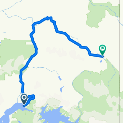
anchorage-eagle river-chugiak-knik river-butte-palmer-wasilla-houston-nancy lake-willow lake
(cloned from route 767258)
- -:--
- Duration
- 155.5 km
- Distance
- 942 m
- Ascent
- 889 m
- Descent
- ---
- Avg. speed
- ---
- Max. altitude

Route highlights
Points of interest along the route
Point of interest after 83.3 km
Wolf Country RV park and campground http://www.camping-usa.com/campdetails/12725/
Point of interest after 109.7 km
Green Ridge Camper Park
Point of interest after 134.6 km
Big Lake South State Recreation Area (Mat Su Region) http://dnr.alaska.gov/parks/aspunits/matsu/biglakesosrs.htm
Point of interest after 136.8 km
Riverside camper site http://www.karo-ent.com/riversd.htm
Point of interest after 137.8 km
Continue with Bikemap
Use, edit, or download this cycling route
You would like to ride 001.1 panamericana anchorage-willow lake or customize it for your own trip? Here is what you can do with this Bikemap route:
Free features
- Save this route as favorite or in collections
- Copy & plan your own version of this route
- Split it into stages to create a multi-day tour
- Sync your route with Garmin or Wahoo
Premium features
Free trial for 3 days, or one-time payment. More about Bikemap Premium.
- Navigate this route on iOS & Android
- Export a GPX / KML file of this route
- Create your custom printout (try it for free)
- Download this route for offline navigation
Discover more Premium features.
Get Bikemap PremiumFrom our community
Other popular routes starting in Anchorage
 Viaggiamondo in Alaska
- Distance
- 5,421.2 km
- Ascent
- 1,956 m
- Descent
- 1,944 m
- Location
- Anchorage, Alaska, United States
 Alaska
- Distance
- 1,488.4 km
- Ascent
- 2,652 m
- Descent
- 2,645 m
- Location
- Anchorage, Alaska, United States
 001.1 panamericana anchorage-willow lake
- Distance
- 155.5 km
- Ascent
- 942 m
- Descent
- 889 m
- Location
- Anchorage, Alaska, United States
 Anch test
- Distance
- 6.9 km
- Ascent
- 63 m
- Descent
- 66 m
- Location
- Anchorage, Alaska, United States
 Riverstone Way 502, Anchorage to Fairweather Park Loop 7133, Anchorage
- Distance
- 8.7 km
- Ascent
- 285 m
- Descent
- 282 m
- Location
- Anchorage, Alaska, United States
 Panamerika 2011
- Distance
- 985.7 km
- Ascent
- 1,864 m
- Descent
- 1,338 m
- Location
- Anchorage, Alaska, United States
 awesome ride in anchorage with frim!
- Distance
- 9 km
- Ascent
- 41 m
- Descent
- 60 m
- Location
- Anchorage, Alaska, United States
 USA, Alaska, Kanada, Britsh Columbia
- Distance
- 4,454.5 km
- Ascent
- 4,396 m
- Descent
- 3,981 m
- Location
- Anchorage, Alaska, United States
Open it in the app