


Csongrád megye - Route 5
- 92 km
- 23 m
- 24 m
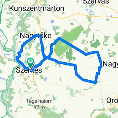
- Szentes, Csongrád megye, Hungary
A cycling route starting in Szentes, Csongrád megye, Hungary.
Overview
The route of the Alföldi Kék Tour from Szentest to Sátoraljaújhely.
created this 10 years ago
Route quality
Track
125.4 km
(21 %)
Quiet road
113.5 km
(19 %)
Paved
226.9 km
(38 %)
Unpaved
29.9 km
(5 %)
Asphalt
215 km
(36 %)
Paved (undefined)
11.9 km
(2 %)
Continue with Bikemap
You would like to ride alföldi kék 2015 or customize it for your own trip? Here is what you can do with this Bikemap route:
Free trial for 3 days, or one-time payment. More about Bikemap Premium.
Discover more Premium features.
Get Bikemap PremiumFrom our community
Open it in the app


