
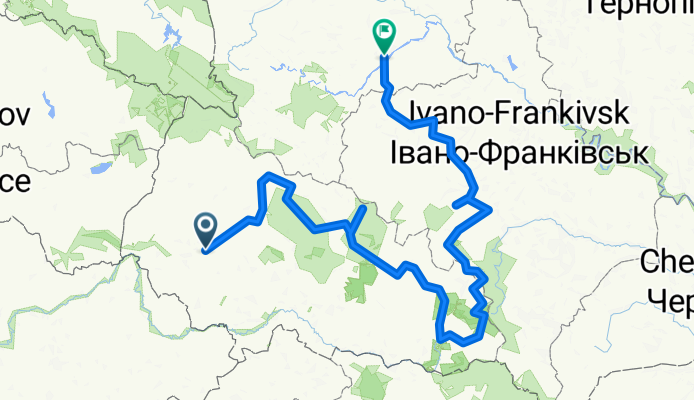
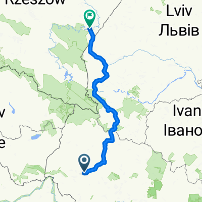
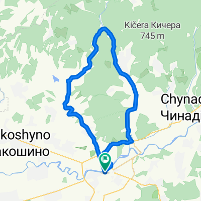
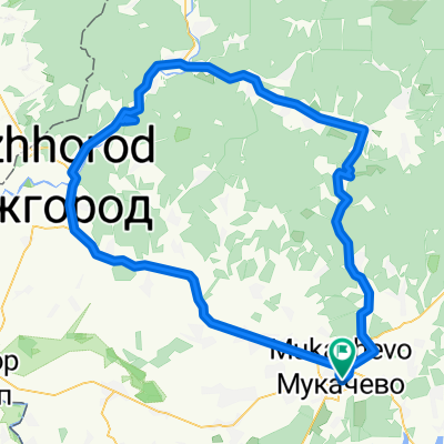
Карпаты велопоход 3-к.с.
A cycling route starting in Mukachevo, Zakarpattia Oblast, Ukraine.
Overview
About this route
m. Mukachevo – m. Volovets – village Huklyvy – mountain Velyu Verkh (1598 m asl) – Prislip pass – village Lozjanski – to the slopes in Mizhhiria - center in Mizhhiria – turn to village Synevir – village Synevir – Synevir lake – village Synevir – village Negrovec – village Kolochava – Prislop pass – village Komsomolsk – village Ust-Chorna – village Lopukhiv (turn to Shasa ridge) – mountain Podpula – Dogiaska lake – mountain Stig – town Rakhiv – village Lugi – Hoverla-Petros link – Kozmeshik - KSS Lazeshchyna – Yablunetsky pass – turn to village Palyanytsia – village Palyanytsia – Bukovel - village Bystrytsia
- -:--
- Duration
- 509 km
- Distance
- 4,700 m
- Ascent
- 4,514 m
- Descent
- ---
- Avg. speed
- ---
- Max. altitude

Continue with Bikemap
Use, edit, or download this cycling route
You would like to ride Карпаты велопоход 3-к.с. or customize it for your own trip? Here is what you can do with this Bikemap route:
Free features
- Save this route as favorite or in collections
- Copy & plan your own version of this route
- Split it into stages to create a multi-day tour
- Sync your route with Garmin or Wahoo
Premium features
Free trial for 3 days, or one-time payment. More about Bikemap Premium.
- Navigate this route on iOS & Android
- Export a GPX / KML file of this route
- Create your custom printout (try it for free)
- Download this route for offline navigation
Discover more Premium features.
Get Bikemap PremiumFrom our community
Other popular routes starting in Mukachevo
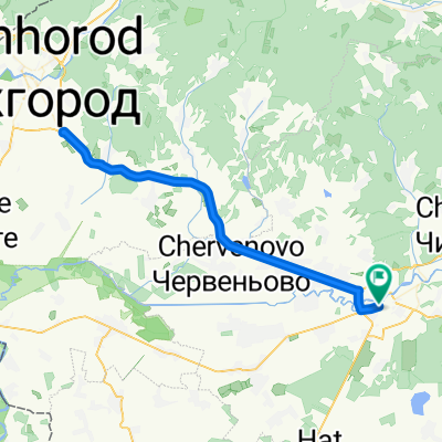
 Мукачеве-Ужгород
- Distance
- 43.5 km
- Ascent
- 25 m
- Descent
- 35 m
- Location
- Mukachevo, Zakarpattia Oblast, Ukraine
 Велопоход 2015
- Distance
- 230.4 km
- Ascent
- 2,974 m
- Descent
- 2,888 m
- Location
- Mukachevo, Zakarpattia Oblast, Ukraine
 мукачево Лисарня
- Distance
- 39.6 km
- Ascent
- 404 m
- Descent
- 404 m
- Location
- Mukachevo, Zakarpattia Oblast, Ukraine
 Route to вулиця Вокзальна 49, Мукачево
- Distance
- 128.3 km
- Ascent
- 1,776 m
- Descent
- 1,824 m
- Location
- Mukachevo, Zakarpattia Oblast, Ukraine
 Карпаты велопоход 3-к.с.
- Distance
- 508.9 km
- Ascent
- 4,776 m
- Descent
- 4,591 m
- Location
- Mukachevo, Zakarpattia Oblast, Ukraine
 Mukachevo - Uzhgorod 72km, 300asc
- Distance
- 72 km
- Ascent
- 208 m
- Descent
- 209 m
- Location
- Mukachevo, Zakarpattia Oblast, Ukraine
 Велопоход 2015
- Distance
- 250.4 km
- Ascent
- 2,521 m
- Descent
- 2,361 m
- Location
- Mukachevo, Zakarpattia Oblast, Ukraine
 вулиця Вокзальна 49, Мукачево to вулиця Вокзальна 49, Мукачево
- Distance
- 137.3 km
- Ascent
- 1,325 m
- Descent
- 1,393 m
- Location
- Mukachevo, Zakarpattia Oblast, Ukraine
Open it in the app