Stever Radweg - Burg und Saline im Ruhrgebiet
A cycling route starting in Haltern, North Rhine-Westphalia, Germany.
Overview
About this route
Einfach mal den Blick schweifen lassen, still beobachten, wie sich eine Welt entwickelt, die nicht von Menschenhand geprägt ist. Friedlich weidende und ungestörte Natur. Die Steveraue bietet Ihnen ein einmaliges Naturerlebnis, das Sie mit allen Sinnen genießen können.
- -:--
- Duration
- 60.7 km
- Distance
- 167 m
- Ascent
- 142 m
- Descent
- ---
- Avg. speed
- ---
- Avg. speed
Route quality
Waytypes & surfaces along the route
Waytypes
Path
28.4 km
(47 %)
Quiet road
19.9 km
(33 %)
Surfaces
Paved
40 km
(66 %)
Unpaved
17.5 km
(29 %)
Asphalt
32.7 km
(54 %)
Gravel
14.3 km
(24 %)
Route highlights
Points of interest along the route
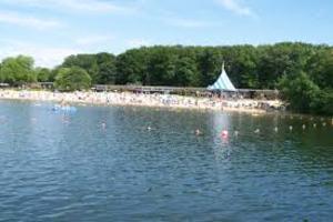
Photo after 3.4 km
Halterner Stausee

Photo after 7.4 km
Die Stever ist ein etwa 58 km[2] langer, rechtsseitiger Zufluss der Lippe in den nordrhein-westfälischen Kreisen Coesfeld, Unna und Recklinghausen. Das Flusstal von der Quelle bis zur Mündung wird seit alters her Stevergau genannt, der zusammen mit dem Dreingau die Landschaft des südlichen Münsterlandes bildet.
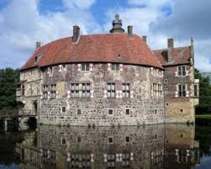
Photo after 27 km
Die Burg Vischering ist eine münsterländische Wasserburg am nördlichen Rand der nordrhein-westfälischen Stadt Lüdinghausen.
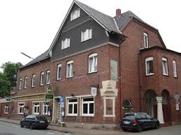
Accommodation after 36.9 km
Hotel-Restaurant Plettenberger Hof Schlossstraße 28 59394 Nordkirchen Telefon: 02596 927-0 Öffnungszeiten Sa. 11:30-15:00
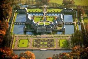
Photo after 37.7 km
Schloss Nordkirchen. Das Schloss Nordkirchen ist eine barocke Schlossanlage im südlichen Münsterland gut 25 Kilometer südlich von Münster. Sie liegt auf dem Gebiet der Gemeinde Nordkirchen im nordrhein-westfälischen Kreis Coesfeld.
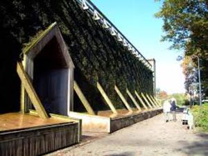
Photo after 52.4 km
Saline am Stadtsee Werne, Solebad. In konsequenter Fortsetzung der Werner Badetradition wurde im Jahre 1990 am Stadtpark, in direkter Nachbarschaft zum Natur-Solebad, ein Gradierwerk errichtet. Die über die aus Schwarzdorn bestehende Rieselwand des Gradierwerkes geleitete Sole bildet durch den Aufprall auf die Dornen einen "Solenebel". Die das Gradierwerk umgebende Luft wird mit Sole angereichert, so daß ein maritimes Klima entsteht, das gerade bei Atemwegserkrankungen sehr heilsam wirkt.

Photo after 53.6 km
Die Lippe ist ein 220 km langer rechter Nebenfluss des Rheins in Nordrhein-Westfalen
Continue with Bikemap
Use, edit, or download this cycling route
You would like to ride Stever Radweg - Burg und Saline im Ruhrgebiet or customize it for your own trip? Here is what you can do with this Bikemap route:
Free features
- Save this route as favorite or in collections
- Copy & plan your own version of this route
- Sync your route with Garmin or Wahoo
Premium features
Free trial for 3 days, or one-time payment. More about Bikemap Premium.
- Navigate this route on iOS & Android
- Export a GPX / KML file of this route
- Create your custom printout (try it for free)
- Download this route for offline navigation
Discover more Premium features.
Get Bikemap PremiumFrom our community
Other popular routes starting in Haltern
 Haltern, See, 53km
- Distance
- 53.1 km
- Ascent
- 352 m
- Descent
- 351 m
- Location
- Haltern, North Rhine-Westphalia, Germany
 Ausfahrt durch Haltern am See
- Distance
- 24.8 km
- Ascent
- 99 m
- Descent
- 99 m
- Location
- Haltern, North Rhine-Westphalia, Germany
 R 10 Dülmen Start Haltern am See
- Distance
- 63.8 km
- Ascent
- 276 m
- Descent
- 277 m
- Location
- Haltern, North Rhine-Westphalia, Germany
 Runde um Borkenberge
- Distance
- 39.4 km
- Ascent
- 114 m
- Descent
- 112 m
- Location
- Haltern, North Rhine-Westphalia, Germany
 Tour mit Udo und Anette
- Distance
- 19 km
- Ascent
- 161 m
- Descent
- 166 m
- Location
- Haltern, North Rhine-Westphalia, Germany
 Haltern-Olfen-Haltern
- Distance
- 39.3 km
- Ascent
- 66 m
- Descent
- 65 m
- Location
- Haltern, North Rhine-Westphalia, Germany
 18 km Vollgas durch die Hohe Mark
- Distance
- 18.1 km
- Ascent
- 190 m
- Descent
- 190 m
- Location
- Haltern, North Rhine-Westphalia, Germany
 Rundkurs Haltern am See
- Distance
- 47.6 km
- Ascent
- 282 m
- Descent
- 280 m
- Location
- Haltern, North Rhine-Westphalia, Germany
Open it in the app


