

Gransee Tonstichlandschaft Zehdenick Lehnitz
A cycling route starting in Gransee, Brandenburg, Germany.
Overview
About this route
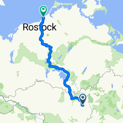
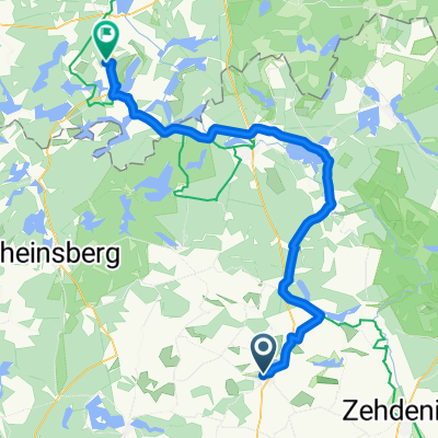
Dieser Radausflug besteht aus sehr unterschiedlichen Abschnitten. Der Anfahrt vom Bahnhof Gransee zum Beginn der Tonstichlandschaft bei Burgwall, dem Radeln durch die Tonstiche, der sehenswerten Kleinstadt Zehdenick mit ihren Kamelbrücken, dem Radeln am Vosskanal, dem Radweg durch den Mischwald bis zum Havelkanal und schließlich dem Radeln am Havel-Oder Kanal und dem Ostufer des Lehnitzsee bis zum Bahnhof Lehnitz
- -:--
- Duration
- 64.4 km
- Distance
- 71 m
- Ascent
- 95 m
- Descent
- ---
- Avg. speed
- ---
- Max. altitude

Route quality
Waytypes & surfaces along the route
Waytypes
Track
20 km
(31 %)
Quiet road
14.8 km
(23 %)
Surfaces
Paved
47.7 km
(74 %)
Unpaved
8.4 km
(13 %)
Asphalt
47.7 km
(74 %)
Gravel
5.8 km
(9 %)
Continue with Bikemap
Use, edit, or download this cycling route
You would like to ride Gransee Tonstichlandschaft Zehdenick Lehnitz or customize it for your own trip? Here is what you can do with this Bikemap route:
Free features
- Save this route as favorite or in collections
- Copy & plan your own version of this route
- Sync your route with Garmin or Wahoo
Premium features
Free trial for 3 days, or one-time payment. More about Bikemap Premium.
- Navigate this route on iOS & Android
- Export a GPX / KML file of this route
- Create your custom printout (try it for free)
- Download this route for offline navigation
Discover more Premium features.
Get Bikemap PremiumFrom our community
Other popular routes starting in Gransee
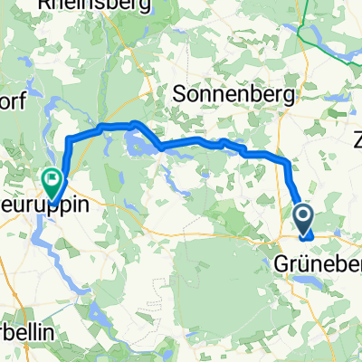
 Havelquelle-Tour
- Distance
- 150.7 km
- Ascent
- 567 m
- Descent
- 554 m
- Location
- Gransee, Brandenburg, Germany
 Route zu Camping Am Bauernhof
- Distance
- 57.8 km
- Ascent
- 388 m
- Descent
- 352 m
- Location
- Gransee, Brandenburg, Germany
 Berlin Graal-Müritz
- Distance
- 222.5 km
- Ascent
- 257 m
- Descent
- 291 m
- Location
- Gransee, Brandenburg, Germany
 Gransee nach Bad Saarow
- Distance
- 129.8 km
- Ascent
- 151 m
- Descent
- 162 m
- Location
- Gransee, Brandenburg, Germany
 Gransee - Fürstenberg - Lychen
- Distance
- 89.6 km
- Ascent
- 630 m
- Descent
- 631 m
- Location
- Gransee, Brandenburg, Germany
 Gra-Lbrg-Sto-Ang150
- Distance
- 149.1 km
- Ascent
- 235 m
- Descent
- 247 m
- Location
- Gransee, Brandenburg, Germany
 Schinkelplatz nach Johannesruh
- Distance
- 51.8 km
- Ascent
- 638 m
- Descent
- 658 m
- Location
- Gransee, Brandenburg, Germany
 Löwenberg (Mark) nach Hermsdorfer Weg
- Distance
- 39.9 km
- Ascent
- 217 m
- Descent
- 236 m
- Location
- Gransee, Brandenburg, Germany
Open it in the app