

04-110-1485-BERN
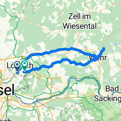
A cycling route starting in Loerrach, Baden-Württemberg, Germany.
Overview
About this route
Lörrach-Augst-Liestal-A2-Oensingen-Wangen an der Are-Wangenstraße-Deitingen-Kriegstetten-Koppingen-Niederrösch-Kirchberg-Lyssach- Wegteilung -Hindelbank-ittingen-Bern
Ziel: JH Bern Weihergasse 4 CH - 3005 Bern
- -:--
- Duration
- 108.2 km
- Distance
- 706 m
- Ascent
- 497 m
- Descent
- ---
- Avg. speed
- ---
- Avg. speed
Route quality
Waytypes & surfaces along the route
Waytypes
Busy road
40.2 km
(37 %)
Quiet road
36.6 km
(34 %)
Surfaces
Paved
77.9 km
(72 %)
Unpaved
1.3 km
(1 %)
Asphalt
74.9 km
(69 %)
Paved (undefined)
2.6 km
(2 %)
Continue with Bikemap
Use, edit, or download this cycling route
You would like to ride 04-110-1485-BERN or customize it for your own trip? Here is what you can do with this Bikemap route:
Free features
- Save this route as favorite or in collections
- Copy & plan your own version of this route
- Split it into stages to create a multi-day tour
- Sync your route with Garmin or Wahoo
Premium features
Free trial for 3 days, or one-time payment. More about Bikemap Premium.
- Navigate this route on iOS & Android
- Export a GPX / KML file of this route
- Create your custom printout (try it for free)
- Download this route for offline navigation
Discover more Premium features.
Get Bikemap PremiumFrom our community
Other popular routes starting in Loerrach
 Brombach-Reinach
- Distance
- 20.1 km
- Ascent
- 67 m
- Descent
- 72 m
- Location
- Loerrach, Baden-Württemberg, Germany
 Schöne Tour Lö-Markgräflerland-FR-Lö
- Distance
- 79.1 km
- Ascent
- 590 m
- Descent
- 590 m
- Location
- Loerrach, Baden-Württemberg, Germany
 Lörrach - Adelhausen - Rheinfelden - Weil - Lörrach
- Distance
- 49.8 km
- Ascent
- 288 m
- Descent
- 288 m
- Location
- Loerrach, Baden-Württemberg, Germany
 Wiese-Schopfheim-Wehr-Dossenbach-Salzert
- Distance
- 50 km
- Ascent
- 548 m
- Descent
- 469 m
- Location
- Loerrach, Baden-Württemberg, Germany
 Lörrach-Feldberg-Lörrach
- Distance
- 101.2 km
- Ascent
- 2,165 m
- Descent
- 2,127 m
- Location
- Loerrach, Baden-Württemberg, Germany
 Lörrach + Alpenrand nach Prien/Chiemsee
- Distance
- 526.1 km
- Ascent
- 5,045 m
- Descent
- 4,801 m
- Location
- Loerrach, Baden-Württemberg, Germany
 Von Lörrach in den Naturpark Südschwarzwald, Wiese und Vogelpark Steinen
- Distance
- 36.2 km
- Ascent
- 540 m
- Descent
- 541 m
- Location
- Loerrach, Baden-Württemberg, Germany
 Lörrach - St. Chrischona - Lörrach
- Distance
- 33.4 km
- Ascent
- 618 m
- Descent
- 570 m
- Location
- Loerrach, Baden-Württemberg, Germany
Open it in the app