

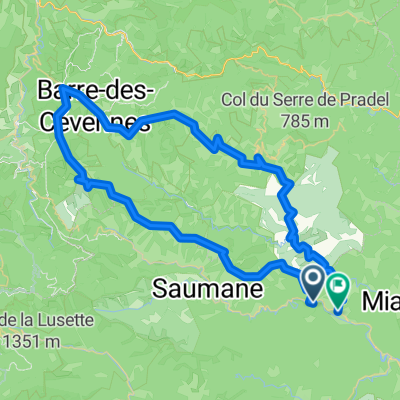
D 260a - Route de la Corniche des Cévennes
A cycling route starting in Saint-Jean-du-Gard, Occitanie, France.
Overview
About this route
- 4 h 38 min
- Duration
- 83.6 km
- Distance
- 1,206 m
- Ascent
- 1,216 m
- Descent
- 18 km/h
- Avg. speed
- ---
- Max. altitude
Route quality
Waytypes & surfaces along the route
Waytypes
Quiet road
0.8 km
(1 %)
Undefined
82.7 km
(99 %)
Surfaces
Paved
32.6 km
(39 %)
Asphalt
32.6 km
(39 %)
Undefined
51 km
(61 %)
Route highlights
Points of interest along the route
Point of interest after 8.1 km
Point of interest after 8.1 km
Continue with Bikemap
Use, edit, or download this cycling route
You would like to ride D 260a - Route de la Corniche des Cévennes or customize it for your own trip? Here is what you can do with this Bikemap route:
Free features
- Save this route as favorite or in collections
- Copy & plan your own version of this route
- Split it into stages to create a multi-day tour
- Sync your route with Garmin or Wahoo
Premium features
Free trial for 3 days, or one-time payment. More about Bikemap Premium.
- Navigate this route on iOS & Android
- Export a GPX / KML file of this route
- Create your custom printout (try it for free)
- Download this route for offline navigation
Discover more Premium features.
Get Bikemap PremiumFrom our community
Other popular routes starting in Saint-Jean-du-Gard
 Saint-Jean-du-Gard - Le Vigan
- Distance
- 53.2 km
- Ascent
- 887 m
- Descent
- 892 m
- Location
- Saint-Jean-du-Gard, Occitanie, France
 2016 Ride Day 158 - St-Jean-du-Gard Circle to Le Pompidou
- Distance
- 65.5 km
- Ascent
- 754 m
- Descent
- 754 m
- Location
- Saint-Jean-du-Gard, Occitanie, France
 Ride Day 26—7 Oct 2005—30270 St Jean-du-Gard — Circle
- Distance
- 32.1 km
- Ascent
- 387 m
- Descent
- 387 m
- Location
- Saint-Jean-du-Gard, Occitanie, France
 30 Asclier - St Roman
- Distance
- 54.7 km
- Ascent
- 1,115 m
- Descent
- 1,115 m
- Location
- Saint-Jean-du-Gard, Occitanie, France
 D 260a - Route de la Corniche des Cévennes
- Distance
- 83.6 km
- Ascent
- 1,206 m
- Descent
- 1,216 m
- Location
- Saint-Jean-du-Gard, Occitanie, France
 2016 Ride Day 159 - St-Jean-du-Gard to Ispagnac
- Distance
- 70.8 km
- Ascent
- 933 m
- Descent
- 592 m
- Location
- Saint-Jean-du-Gard, Occitanie, France
 2016 Ride Day 66 - Saint-Jean-du-Gard Circle through Col du Mercou
- Distance
- 41.9 km
- Ascent
- 755 m
- Descent
- 755 m
- Location
- Saint-Jean-du-Gard, Occitanie, France
 2016 Ride Day 157 - St-Jean-du-Gard Circle to St-Martin-de-Lansuscle
- Distance
- 66.6 km
- Ascent
- 891 m
- Descent
- 892 m
- Location
- Saint-Jean-du-Gard, Occitanie, France
Open it in the app