April Sonnen Trailfeuerwerk CLONED FROM ROUTE 444917
- 31.2 km
- 667 m
- 670 m
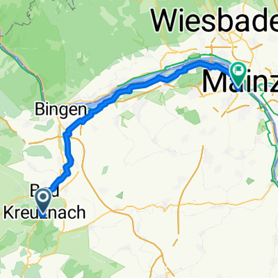
- Bad Kreuznach, Rhineland-Palatinate, Germany
A cycling route starting in Bad Kreuznach, Rhineland-Palatinate, Germany.
Overview
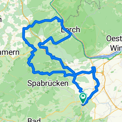
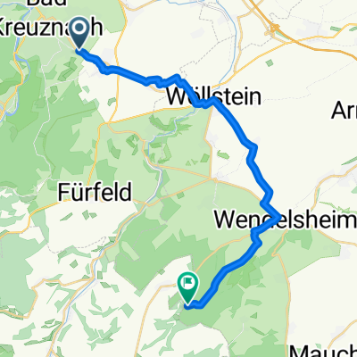
Bad Kreuznach – auf dem Naheradweg durch das Salinental – Bad Münster am Stein-Ebernburg entlang der Alszenz nach Altenbamberg – Steigerhof – Fürfeld – Neu-Bamberg – Frei-Laubersheim – Wöllstein – Pleitersheim – Badenheim --Pfaffen-Schwabenheim– Planig--Bad Kreuznach
Länge: 47 km Höhenmeter: 350 hm Hinweis: ab Altenbamberg langer Anstieg. Landschaftlich vielseitige Tour, überwiegend auf wenig befahrenen klassifizierten Straßen. (cloned from route 2259804) (cloned from route 3206716)created this 10 years ago
Route quality
Track
14.2 km
(31 %)
Quiet road
9.7 km
(21 %)
Paved
36.3 km
(79 %)
Unpaved
4.6 km
(10 %)
Asphalt
28.5 km
(62 %)
Paved (undefined)
6.9 km
(15 %)
Continue with Bikemap
You would like to ride Vom Nahetal in die Rheinhessische Schweiz or customize it for your own trip? Here is what you can do with this Bikemap route:
Free trial for 3 days, or one-time payment. More about Bikemap Premium.
Discover more Premium features.
Get Bikemap PremiumFrom our community
Open it in the app