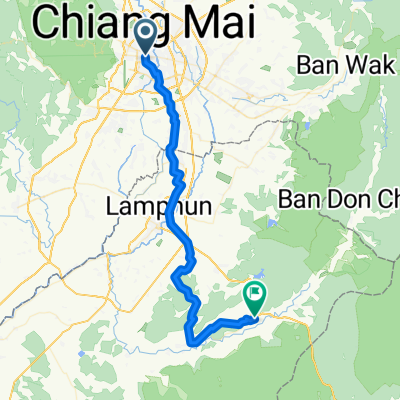
biking in Chiang Mai
- 5.2 km
- 207 m
- 202 m
- Chiang Mai, Chiang Mai, Thailand
A cycling route starting in Chiang Mai, Chiang Mai, Thailand.
Overview
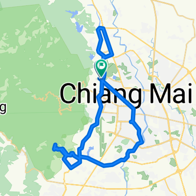
This is probably the easiest downhill route from Doi Pui. It starts near Doi Pui summit. The first few km are paved. The road then transitions into unpaved double track; shortly after that there is the hilltribe coffee shop which offers great mountain views and homegrown coffee. The entire trail is fairly steep and requires sensible brake use. The upper part is frequented by cars and motorcycles, so be careful. The trail ends at Huay Tueng Tao lake, which is ideal for a lunch/dinner break or for taking a swim.
There are three options to get your bike up Doi Pui: pedalling up Sriwichai Rd., pushing it up the (shorter) hiking trails, or taking a taxi from the zoo at Huay Kaeow Rd.(cloned from route 1995180)
created this 10 years ago
Continue with Bikemap
You would like to ride Eagles Route Downhill or customize it for your own trip? Here is what you can do with this Bikemap route:
Free trial for 3 days, or one-time payment. More about Bikemap Premium.
Discover more Premium features.
Get Bikemap PremiumFrom our community
Open it in the app