

Day Bike Ride - Bran Zarnesti Magura Bran
A cycling route starting in Bran, Brașov County, Romania.
Overview
About this route
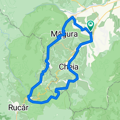
day tour from Bran Castle - over hills of traditional village of Magura back to Bran Castle
- -:--
- Duration
- 25.9 km
- Distance
- 500 m
- Ascent
- 498 m
- Descent
- ---
- Avg. speed
- ---
- Max. altitude

Route quality
Waytypes & surfaces along the route
Waytypes
Quiet road
10.4 km
(40 %)
Cycleway
2.3 km
(9 %)
Surfaces
Paved
14 km
(54 %)
Unpaved
11.7 km
(45 %)
Asphalt
13.7 km
(53 %)
Gravel
11.7 km
(45 %)
Continue with Bikemap
Use, edit, or download this cycling route
You would like to ride Day Bike Ride - Bran Zarnesti Magura Bran or customize it for your own trip? Here is what you can do with this Bikemap route:
Free features
- Save this route as favorite or in collections
- Copy & plan your own version of this route
- Sync your route with Garmin or Wahoo
Premium features
Free trial for 3 days, or one-time payment. More about Bikemap Premium.
- Navigate this route on iOS & Android
- Export a GPX / KML file of this route
- Create your custom printout (try it for free)
- Download this route for offline navigation
Discover more Premium features.
Get Bikemap PremiumFrom our community
Other popular routes starting in Bran
 PiatraCraiuluiNatPark, Bike Ride - Bran Castle and the Gorge
- Distance
- 36.1 km
- Ascent
- 902 m
- Descent
- 900 m
- Location
- Bran, Brașov County, Romania
 Predelut-Tohanita-Zarnesti-Plaiul Foii-Cantonul Rudarita
- Distance
- 27.4 km
- Ascent
- 657 m
- Descent
- 349 m
- Location
- Bran, Brașov County, Romania
 simon - gutanu - moieciu de sus - simon
- Distance
- 32.9 km
- Ascent
- 982 m
- Descent
- 979 m
- Location
- Bran, Brașov County, Romania
 bike tour through Predeluț
- Distance
- 12.5 km
- Ascent
- 172 m
- Descent
- 168 m
- Location
- Bran, Brașov County, Romania
 short ride bran balaban
- Distance
- 15.9 km
- Ascent
- 734 m
- Descent
- 752 m
- Location
- Bran, Brașov County, Romania
 Day Bike Ride - Bran Zarnesti Magura Bran
- Distance
- 25.9 km
- Ascent
- 500 m
- Descent
- 498 m
- Location
- Bran, Brașov County, Romania
 Predelut - Bran - Moieciu Jos - Cheia - Fundatica - Valea Cheii - Dambovicioara - Ciocanu - Sirnea - Pestera - Magura - Zarnesti - Predelut
- Distance
- 63.8 km
- Ascent
- 1,186 m
- Descent
- 1,186 m
- Location
- Bran, Brașov County, Romania
 Bran Moeciu Circuit sate
- Distance
- 47.2 km
- Ascent
- 1,069 m
- Descent
- 1,069 m
- Location
- Bran, Brașov County, Romania
Open it in the app