

slovensko 2015
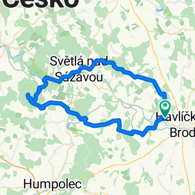
A cycling route starting in Havlíčkův Brod, Kraj Vysočina, Czechia.
Overview
About this route
radek + vaclav + dan 7/2015
- -:--
- Duration
- 863.1 km
- Distance
- 1,033 m
- Ascent
- 1,339 m
- Descent
- ---
- Avg. speed
- ---
- Max. altitude

Route quality
Waytypes & surfaces along the route
Waytypes
Road
267.6 km
(31 %)
Quiet road
103.6 km
(12 %)
Surfaces
Paved
466.1 km
(54 %)
Unpaved
25.9 km
(3 %)
Asphalt
466.1 km
(54 %)
Gravel
17.3 km
(2 %)
Continue with Bikemap
Use, edit, or download this cycling route
You would like to ride slovensko 2015 or customize it for your own trip? Here is what you can do with this Bikemap route:
Free features
- Save this route as favorite or in collections
- Copy & plan your own version of this route
- Split it into stages to create a multi-day tour
- Sync your route with Garmin or Wahoo
Premium features
Free trial for 3 days, or one-time payment. More about Bikemap Premium.
- Navigate this route on iOS & Android
- Export a GPX / KML file of this route
- Create your custom printout (try it for free)
- Download this route for offline navigation
Discover more Premium features.
Get Bikemap PremiumFrom our community
Other popular routes starting in Havlíčkův Brod
 Výlet do Přibyslavi
- Distance
- 36.9 km
- Ascent
- 372 m
- Descent
- 372 m
- Location
- Havlíčkův Brod, Kraj Vysočina, Czechia
 H.Brod - Lipnice - Světlá - H. Brod
- Distance
- 39.8 km
- Ascent
- 456 m
- Descent
- 456 m
- Location
- Havlíčkův Brod, Kraj Vysočina, Czechia
 Na Pelestrov2
- Distance
- 30.5 km
- Ascent
- 352 m
- Descent
- 352 m
- Location
- Havlíčkův Brod, Kraj Vysočina, Czechia
 110612 loudacka nanecisto podruhe
- Distance
- 133.5 km
- Ascent
- 859 m
- Descent
- 1,009 m
- Location
- Havlíčkův Brod, Kraj Vysočina, Czechia
 slovensko 2015
- Distance
- 863.1 km
- Ascent
- 1,033 m
- Descent
- 1,339 m
- Location
- Havlíčkův Brod, Kraj Vysočina, Czechia
 HB - Knik - Habry - S n/S - Lipnice - KH - HB
- Distance
- 61.9 km
- Ascent
- 578 m
- Descent
- 578 m
- Location
- Havlíčkův Brod, Kraj Vysočina, Czechia
 nemecko 2012
- Distance
- 625.1 km
- Ascent
- 522 m
- Descent
- 944 m
- Location
- Havlíčkův Brod, Kraj Vysočina, Czechia
 Melechov 2009
- Distance
- 52.5 km
- Ascent
- 1,063 m
- Descent
- 1,041 m
- Location
- Havlíčkův Brod, Kraj Vysočina, Czechia
Open it in the app