

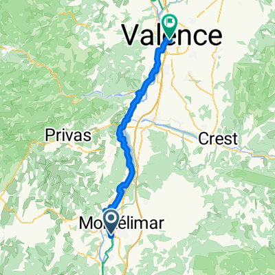
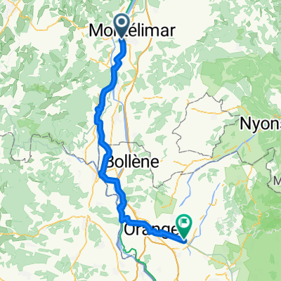
Via Rhona Official: Day 7
A cycling route starting in Le Teil, Auvergne-Rhône-Alpes, France.
Overview
About this route
Complete Official Via Rhona GPX, as of August 2015
- -:--
- Duration
- 43.4 km
- Distance
- 69 m
- Ascent
- 90 m
- Descent
- ---
- Avg. speed
- ---
- Max. altitude

Route quality
Waytypes & surfaces along the route
Waytypes
Quiet road
27.8 km
(64 %)
Cycleway
9.6 km
(22 %)
Surfaces
Paved
28.7 km
(66 %)
Unpaved
0.4 km
(1 %)
Asphalt
28.7 km
(66 %)
Ground
0.4 km
(1 %)
Undefined
14.3 km
(33 %)
Continue with Bikemap
Use, edit, or download this cycling route
You would like to ride Via Rhona Official: Day 7 or customize it for your own trip? Here is what you can do with this Bikemap route:
Free features
- Save this route as favorite or in collections
- Copy & plan your own version of this route
- Sync your route with Garmin or Wahoo
Premium features
Free trial for 3 days, or one-time payment. More about Bikemap Premium.
- Navigate this route on iOS & Android
- Export a GPX / KML file of this route
- Create your custom printout (try it for free)
- Download this route for offline navigation
Discover more Premium features.
Get Bikemap PremiumFrom our community
Other popular routes starting in Le Teil
 Le Teil - Valence
- Distance
- 61 km
- Ascent
- 83 m
- Descent
- 48 m
- Location
- Le Teil, Auvergne-Rhône-Alpes, France
 Rhone-Ardeche
- Distance
- 54.3 km
- Ascent
- 470 m
- Descent
- 468 m
- Location
- Le Teil, Auvergne-Rhône-Alpes, France
 maison - carcassonne
- Distance
- 380.5 km
- Ascent
- 207 m
- Descent
- 169 m
- Location
- Le Teil, Auvergne-Rhône-Alpes, France
 Le Teil - Jonquières
- Distance
- 75 km
- Ascent
- 189 m
- Descent
- 210 m
- Location
- Le Teil, Auvergne-Rhône-Alpes, France
 Variante Le Teil - St Andre
- Distance
- 80.3 km
- Ascent
- 787 m
- Descent
- 406 m
- Location
- Le Teil, Auvergne-Rhône-Alpes, France
 Via Rhona Official: Day 7
- Distance
- 43.4 km
- Ascent
- 69 m
- Descent
- 90 m
- Location
- Le Teil, Auvergne-Rhône-Alpes, France
 Le Teil - St Andre
- Distance
- 75.6 km
- Ascent
- 837 m
- Descent
- 465 m
- Location
- Le Teil, Auvergne-Rhône-Alpes, France
 Montélimqr Lyon
- Distance
- 178.3 km
- Ascent
- 203 m
- Descent
- 109 m
- Location
- Le Teil, Auvergne-Rhône-Alpes, France
Open it in the app