

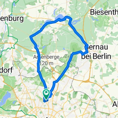
Vinetastraße - Gorinsee Runde
A cycling route starting in Pankow, State of Berlin, Germany.
Overview
About this route
Zwischen den zwei markierten Punkten lohnt es sich auf dem versteckten Sandweg 5 Meter östlich neben der Straße zu fahren, wenn man auf dem groben Kopfsteinpflaster nicht durchgeschüttelt werden will.
- -:--
- Duration
- 41.1 km
- Distance
- 78 m
- Ascent
- 80 m
- Descent
- ---
- Avg. speed
- 69 m
- Max. altitude
Route quality
Waytypes & surfaces along the route
Waytypes
Busy road
13.7 km
(33 %)
Quiet road
8.3 km
(20 %)
Surfaces
Paved
36.2 km
(88 %)
Unpaved
3.7 km
(9 %)
Asphalt
29.5 km
(72 %)
Paving stones
6.2 km
(15 %)
Route highlights
Points of interest along the route
Point of interest after 25.6 km
Sandweg Anfang
Point of interest after 26.3 km
Sandweg Ende
Continue with Bikemap
Use, edit, or download this cycling route
You would like to ride Vinetastraße - Gorinsee Runde or customize it for your own trip? Here is what you can do with this Bikemap route:
Free features
- Save this route as favorite or in collections
- Copy & plan your own version of this route
- Sync your route with Garmin or Wahoo
Premium features
Free trial for 3 days, or one-time payment. More about Bikemap Premium.
- Navigate this route on iOS & Android
- Export a GPX / KML file of this route
- Create your custom printout (try it for free)
- Download this route for offline navigation
Discover more Premium features.
Get Bikemap PremiumFrom our community
Other popular routes starting in Pankow
 Vinetastraße - Gorinsee Runde
- Distance
- 41.1 km
- Ascent
- 78 m
- Descent
- 80 m
- Location
- Pankow, State of Berlin, Germany
 100 km Runde
- Distance
- 101.6 km
- Ascent
- 258 m
- Descent
- 244 m
- Location
- Pankow, State of Berlin, Germany
 50er Lehnitz
- Distance
- 50.6 km
- Ascent
- 116 m
- Descent
- 113 m
- Location
- Pankow, State of Berlin, Germany
 Berlin-Pankow Ruhlsdorf-Berlin
- Distance
- 82.1 km
- Ascent
- 153 m
- Descent
- 154 m
- Location
- Pankow, State of Berlin, Germany
 70 km - Trainingsrunde Pankow
- Distance
- 72.9 km
- Ascent
- 118 m
- Descent
- 117 m
- Location
- Pankow, State of Berlin, Germany
 Oderbruch-Tour in der Hügel-Variante
- Distance
- 149.6 km
- Ascent
- 336 m
- Descent
- 339 m
- Location
- Pankow, State of Berlin, Germany
 Hausrunde
- Distance
- 37 km
- Ascent
- 71 m
- Descent
- 68 m
- Location
- Pankow, State of Berlin, Germany
 60km Liepnitzsee
- Distance
- 62.8 km
- Ascent
- 172 m
- Descent
- 166 m
- Location
- Pankow, State of Berlin, Germany
Open it in the app